ArcMap 10.2: Landsat Band Composite and NDVI Calculation
This video describes how to make a composite multispectral image of Landsat 8 data and calculate an NDVI model using the image analysis window within ArcMap. Enjoy!
Видео ArcMap 10.2: Landsat Band Composite and NDVI Calculation канала Usman Buhari
Видео ArcMap 10.2: Landsat Band Composite and NDVI Calculation канала Usman Buhari
Показать
Комментарии отсутствуют
Информация о видео
Другие видео канала
 NDVI in ArcGIS
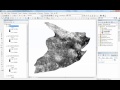 Landsat 8: Estimating Land Surface Temperature Using ArcGIS
 Landsat 8 Image Classification with ArcGIS (Supervised)
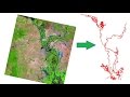 How to extract River shape from Landsat Image
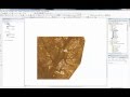 Landsat 8: Atmospheric Correction and Band Rationing Using ArcGIS
 Supervised Image Classification in ArcGIS Desktop - ArcMap
 ArcGIS Pro Map Series
 Creating and Editing Feature Classes in ArcGIS Pro
 Deriving River Network & Catchments from a DEM using QGIS
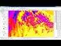 Calculating Land Surface Temperature Landsat8 by ArcGIS
 NDVI | Vegetation/Forest Cover Map in ArcGIS
 Landcover Change Detection using Landsat 8 (Australian Forest Fires 2019-2020)
 How to composite landsat image in ArcGis in Urdu/hindi || Lecture Number 12
 Landsat 7 Composite Band Combinations
 ArcMap 10.2: Zonal Statistics
 NDVI MODIS | Download and Calculate NDVI MODIS MOD13Q1
 how to calculate NDVI using ArcGis
 Download and calculate evapotranspiration MODIS
 Lineament and Lineament Density Map Preparation in Arc GIS
 How to calculate normalized burn ratio (NBR) in QGIS