Supervised Image Classification in ArcGIS Desktop - ArcMap
In this screencast, you will use a Landsat image with supervised classification method to create a land cover map.
For this lab, you will use a Multispectral Landsat Level 1 image which can be downloaded from the USGS website: http://landsatlook.usgs.gov/ (Links to an external site.)Links to an external site.
You are welcome to download a Level 1 Dataset for anywhere in the world. If you want you can use the dataset that I used for the lab.
You are welcome to download a Level 1 Dataset for anywhere in the world. If you want you can use the dataset that I used for the lab.
Landsat Image: https://www.dropbox.com/s/8lgprvmbqrt1vzm/LT50400362011201PAC01.zip?dl=0 (Links to an external site.)Links to an external site.
Study Area (AOI): https://www.dropbox.com/s/ujhb61mcy3d6beb/AOI.zip?dl=0 (Links to an external site.)Links to an external site.
Видео Supervised Image Classification in ArcGIS Desktop - ArcMap канала Moulay Anwar Sounny-Slitine
Показать
Комментарии отсутствуют
Информация о видео
26 октября 2017 г. 18:09:24
00:30:19
Другие видео канала
 Landsat 8 Image Classification with ArcGIS (Supervised)
 Maximum Likelihood Supervised Classification using ArcGIS 10.4.1
 A Complete Beginner's Guide to ArcGIS Desktop (Part 1)
 Accuracy Assessment of an Image Classification in ArcMap
 supervised classification + accuracy assesement report in erdas imagine 2015 and google earth pro 7
 Downloading Landsat 8 images from USGS EarthExplorer
 How to Create LULC using ArcGIS/ Supervised Classification and Calculate Area of LULC
 *Exclusive* Comment faire la classification supervisée sur ArcGis 10.2
 LULC using ArcGIS/ Supervised Classification
 Band Composite or Layerstacking & Pan Sharpening using ArcGIS
 Supervised Image Classification using ArcGIS
 Water body Extraction from Any Satellite Image Easy Steps
 How to Georeference in ArcGIS Pro
 Showing DEM in 3D View in ArcGIS || DEM in 3D View in ArcMap || DEM in Arcsene
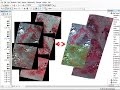 mosaic raster dataset Landsat ArcGis
 Unsupervised Classification in Erdas Imagine Software
 Landsat 8: Atmospheric Correction and Band Rationing Using ArcGIS
 How to Import Lat/Long Coordinates From .csv file Into ArcGIS
 Google Earth Image and Land Cover Classification in ArcGIS || Supervised and Unsupervised
 Mini-Project4: Mapping Glacier Recession in a Warming Climate