Showing DEM in 3D View in ArcGIS || DEM in 3D View in ArcMap || DEM in Arcsene
How to create 3D Terrain, How to show DEM in 3D View? In this tutorial there are stepwise procedure to show the dem in 3D View. Digital Elevation Model, ArcGIS and Dem, 30m dem, are related to Raster data. Hope you will understand.3D Terrain with Google maps,
Subscribe to Best Solution Line
Видео Showing DEM in 3D View in ArcGIS || DEM in 3D View in ArcMap || DEM in Arcsene канала Best Solution Line
Subscribe to Best Solution Line
Видео Showing DEM in 3D View in ArcGIS || DEM in 3D View in ArcMap || DEM in Arcsene канала Best Solution Line
Показать
Комментарии отсутствуют
Информация о видео
Другие видео канала
 HOW TO CREATE 3D DIGITAL ELEVATION MODEL ON ESRI ARCGIS
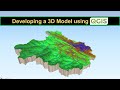 Developing a 3D Model using QGIS
 Calculating the Volume of a Raster using 3D Analyst of ArcGIS (ArcMap + ArcScene)
 Visualize DEM in 3D ll Raster To TIN ll DEM from ArcGIS into ArcScene
 Hydrological modeling in ArcGIS / ArcMap
 Slope, Aspect, Contour , Hillshade Map in ArcGIS
 How to Create 3D Terrain with Google Maps and Blender!
 3D Visualization of a DEM in ArcGIS Pro
 ArcGis 3d Analyst/ ArcScene Animation of flood
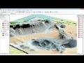 ArcGis 3d analyst Draping an image over a terrain surface
 ArcGIS - ArcScene vuelo 3D - Model Builder | Master SIG
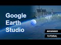 Google Earth Studio - Creating Awesome GeoAnimations
 Comment simuler une inondation dans ArcGIS/ArcMap/ArcScene à partir d'une image DEM.
 How to Create 3D Maps with ArcGis and ArcScene!
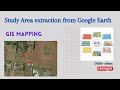 Study Area extraction from Google Earth and Export in ArcMap
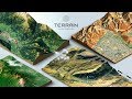 How to create a 3D Terrain with Google Maps and height maps in Photoshop - 3D Map Generator Terrain
 How to create 3D model in Arc Scene
 How to calculate the volume of reservoir of Dam using ArcGIS
 ArcScene 3D Maps
 ArcScene Basics