Landsat 8 Image Classification with ArcGIS (Supervised)
In this video, you will get an introduction to the spectral bands of Landsat 8, usage of different spectral band combinations, perform a supervised classification using ArcGIS and calculate the area corresponding to each landuse class.
Download Landsat 8 Images - https://earthexplorer.usgs.gov/
Видео Landsat 8 Image Classification with ArcGIS (Supervised) канала GeoDelta Labs
Download Landsat 8 Images - https://earthexplorer.usgs.gov/
Видео Landsat 8 Image Classification with ArcGIS (Supervised) канала GeoDelta Labs
Показать
Комментарии отсутствуют
Информация о видео
Другие видео канала
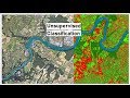 Unsupervised Classification of a satellite image using ArcGIS
 Supervised Image Classification in ArcGIS Desktop - ArcMap
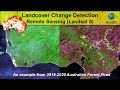 Landcover Change Detection using Landsat 8 (Australian Forest Fires 2019-2020)
 Reclassify & Convert Raster to Shapefile ( Polygon) & Calculate Area Using ArcGIS
 Week06 s02 Area calculation in Raster
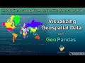 Introduction to Visualizing Geospatial Data with Python GeoPandas
 Landsat 8 NDVI calculation using ArcGIS 10.2 raster calculator
 Supervised Image Classification
 Accuracy Assessment of an Image Classification in ArcMap
 How to use a DEM to delineate a Watershed/Basin in ArcGIS
 Landsat 8: Atmospheric Correction and Band Rationing Using ArcGIS
 IMÁGENES LANDSAT 8 - Descarga y procesamiento en ArcMAP
 Study Area extraction from Google Earth and Export in ArcMap
 how to calculate NDVI using ArcGis
 Composite Landsat 8 bands
 Land use/cover classification using sentinel 2
 Downloading satellite data from USGS websites
 Clip Landsat Imagery in ArcMap Software
 Change Detection Calculation of Different time images through ArcGIS 10.3
 ISO CLUSTER UNSUPERVISED CLASSIFICATION BY ARC GIS 10.3