Downloading Landsat 8 images from USGS EarthExplorer
Quick video tutorial on how to download individual scenes from the Landsat 8 optical remote sensing satellite using the USGS EarthExplorer portal.
Видео Downloading Landsat 8 images from USGS EarthExplorer канала Leonardo Uieda
Видео Downloading Landsat 8 images from USGS EarthExplorer канала Leonardo Uieda
Показать
Комментарии отсутствуют
Информация о видео
Другие видео канала
 Landsat 8 Image Classification with ArcGIS (Supervised)
 HOW TO DOWNLOAD LANDSAT 8 IMAGE FROM USGS EARTH EXPLORER WEBSITE
 9 Things About Landsat 9
 How to download Satellite Images from the USGS, ESA and Google Earth Engine
 Downloading Landsat 8 satellite image data to use in a GIS
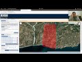 Downloading data from the USGS Earthexplorer
 Download Landsat 8 Data for Free
 How to Download Landsat satellite image / Earth explorer/ USGS
 How to Create LULC using ArcGIS/ Supervised Classification and Calculate Area of LULC
 Adding Landsat 8 satellite images to ArcMap
 Downloading Digital Elevation Data (SRTM) from USGS EarthExplorer
 Download Landsat 8 Satellite Images from Google Earth Engine
 How to download Landsat 8 or any satellite data from USGS Earth explorer
 Calculating NDVI using QGIS and Landsat 8 Images
 NDVI | Vegetation/Forest Cover Map in ArcGIS
 mosaic raster dataset Landsat ArcGis
 How to Download High Resolution Satellite Image from USGS (Glovis) Portal
 How to Download Satellite Image Landsat 8 OLI, 7 ETM+, 4-5 TM, 1-5 MSS
 Comment télécharger des images Landsat et autres données satellitaires sur Earth explorer ( USGS )
 Landsat 8 Image Classification using QGIS