Downloading Landsat 8 satellite image data to use in a GIS
Learn how to find and download free Landsat 8 satellite image data for use in a GIS.
I have many more videos like this as part of my of my online Coursera GIS courses available here: https://www.coursera.org/specializations/gis-mapping-spatial-analysis
If you are interested in taking courses with me at the University of Toronto, you can find out more about my department here: https://geography.utoronto.ca/
Видео Downloading Landsat 8 satellite image data to use in a GIS канала Don Boyes
Показать
Комментарии отсутствуют
Информация о видео
Другие видео канала
 Landsat 8 Image Classification with ArcGIS (Supervised)
 Downloading Landsat 8 images from USGS EarthExplorer
 Adding Landsat 8 satellite images to ArcMap
 How to Download Satellite Image Landsat 8 OLI, 7 ETM+, 4-5 TM, 1-5 MSS
 7. Download Satellite Images inside QGIS
 Downloading data from the USGS Earthexplorer
 Download Landsat 8 Data for Free
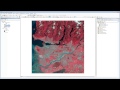 Satellite images in ArcMap - An Introduction
 How To Download Land Use and Land Cover Information (LULC) Map For Any Region
 Supervised Image Classification in ArcGIS Desktop - ArcMap
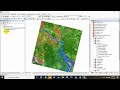 NDVI | Vegetation/Forest Cover Map in ArcGIS
 Download High Resolution Satellite Images USGS 2017 (Updated)
 HOW TO DOWNLOAD LANDSAT 8 IMAGE FROM USGS EARTH EXPLORER WEBSITE
 Downloading Digital Elevation Data (SRTM) from USGS EarthExplorer
 Land use/Land cover Change detection Analysis for an Area over a certain timeline like 1989 to 2020
 Downloading Sentinel Imagery Via Copernicus Open Access Hub
 How to Download Landsat satellite image / Earth explorer/ USGS
 SAS PLANET: Download very High Resolution Google earth Image for free
 How to download Satellite Images from the USGS, ESA and Google Earth Engine
 Calculating Land Surface Temperature using Landsat 8 images by ArcGIS || NDVI ||@GeoTech_Studio