How To Download Land Use and Land Cover Information (LULC) Map For Any Region
In this tutorial, I have demonstrated how to download land use and land cover information map of the world, Finally, I have made the subset of the map for the USA.
Data Download link: https://data.apps.fao.org/map/catalog/srv/eng/catalog.search;jsessionid=C62C6A5B1FEB2B7854F9CCEAEF7E1A95?node=srv#/metadata/6c34ec8b-f31e-4976-9344-fd11b738a850
Install ArcGIS For Free: https://www.youtube.com/watch?v=jx7n4kfKcZ0
#LandUseLandCover
#LULC
#TutorialOnArcGIS
Видео How To Download Land Use and Land Cover Information (LULC) Map For Any Region канала Md Arifur Rahmahn
Показать
Комментарии отсутствуют
Информация о видео
Другие видео канала
 Free download Latest Landuse and Landcover (LULC) raster data for whole world from Esri landcover
 How To Download Digital Soil Map For Any Study Area
 Download ESRI 2020 Latest Land Cover Data 10 m Resolution
 How To Download and Make Time-Series From ERA5 (ECMWF) Dataset
 Land use/Land cover Change detection Analysis for an Area over a certain timeline like 1989 to 2020
 Downloading Sentinel Imagery Via Copernicus Open Access Hub
 Download Contours and DEM from Google Earth
 HOW TO CREATE LOCATION MAP OF STUDY AREA IN QGIS | HOW TO DOWNLOAD FREE SHAPEFILE AND ADD LAYERS
 Flood hazard mapping
 LULC Prediction Tutorial Part 3: Prepare future Land Use Change Prediction Map
 ArcGIS T17: How To Calculate Curve Number From Soil Map
 Google Earth Engine | Landuse/Landcover Modeling | CART Classifier | Validation
 Shapefile download (Country, Road, River, forest cover, buildings, Land use) of any Location
 How to Merge/Mosaic/Join Two Adjacent SOI Toposheet
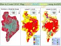 How to create Level-I, Level-II, and Level-III Land Use Land Cover(LULC) map using ArcGis.
 ESRI Latest Land Cover Data 10 m Resolution Released on 24 June 2021
 Downloading OSM data files | Openstreetmap data in GIS
 Download free soil data and create a soil map layout on ArcGIS
![Land use classification using ArcGIS. Landsat 8 image classification [2021]](https://i.ytimg.com/vi/IwsQicKFI-g/default.jpg) Land use classification using ArcGIS. Landsat 8 image classification [2021]
Land use classification using ArcGIS. Landsat 8 image classification [2021] HEC-HMS | T-3 | How to Set up HEC HMS Model