Download High Resolution Satellite Images USGS 2017 (Updated)
If you don't know how to download high resolution satellite images form the usgs website this is for you to learn how to do it properly. You will learn how to set additional criteria when you downloading different type of satellite images including landsat, sentinal 2b etc. Hope you will enjoy and remember to do comment below! like and share with your friends.!
USGS website - https://earthexplorer.usgs.gov/
==For more education==
Imagery and GIS: Best Practices for Extracting Information from Imagery: https://amzn.to/3e8WePF
Remote Sensing Time Series Image Processing (Imaging Science): https://amzn.to/30IsTb7
Advanced Environmental Monitoring with Remote Sensing Time Series Data and R: https://amzn.to/2AvIVuj
If You Like My Video Please #SUBSCRIBE To My Channel For Latest Update.
Thanks For Watching
Don't Forget To Like And Subscribe Our Channel
°°°°°°°°°°°°°°°°°°°°°°°°°°^^^^^^^^^^^^^°°°°°°°°°°°°°°°°°°°
°°°°°°°If you found this video valuable°°°°°°°
1) give it a like.
2) If you know someone who needs to see it, share it.
3) Leave a comment below with your thoughts.
4)Add it to a playlist if you want to watch it later.
-~-~~-~~~-~~-~-
#Seekshow #Subscribe
In this Channel I am talking a lot about these kind of educational and technology, Tips & Tricks, Motivational, Tutorial stuff. If you interested in watching more videos make sure to subscribe to my YouTube channel.
Thanks For Watching
Don't Forget To Like And Subscribe for Seek Show - https://bit.ly/2Ra4xCM
°°°°°°°°°°°°°°°°°°°°°°°°°°^^^^^^^^^^^^^°°°°°°°°°°°°°°°°°°°
Check Below Playlists For More Videos in My Channel
Let's Learn ArcGIS - https://www.youtube.com/watch?v=V041aLRXEeE&list=PLnC1dq66hZqHYGGaM9w-fmfc4KkFQQgOF
Tech Track Show - https://www.youtube.com/watch?v=hzfG9RPwZEk&list=PLnC1dq66hZqGZkXTvtlP30aPgVHIjyJQu
Best Android Games - https://www.youtube.com/watch?v=EA8ixf7l5jY&list=PLnC1dq66hZqHgKsFeEVE0yTtTcmOwf-PK
Around Sri Lanka - https://www.youtube.com/watch?v=v3f6MNoPZ4k&list=PLnC1dq66hZqEVGbWOQXxXnYjDn2aimbwK
Motivational - https://www.youtube.com/playlist?list=PLnC1dq66hZqH2CAgvmd5WEfOWd-38seqV
°°°°°°°If you found this video valuable°°°°°°°
1) give it a like.
2) If you know someone who needs to see it, share it.
3) Leave a comment below with your thoughts.
4)Add it to a playlist if you want to watch it later.
--Follow & Join ?? --
Instagram - https://www.instagram.com/seek_show/
Twitter - https://twitter.com/Seek_Show
Facebook - https://www.facebook.com/seekshowleenath/
For Sponsorships & Offers - leenath91gamage0707@gmail.com
Contact me here if you need my ArcGIS Mapping Services
,
1. To Design Professional Maps For You Data - https://www.fiverr.com/leenathwymkthi/design-professional-maps-for-you-data
2. To Do Any Custom Gis Work Accurately - https://www.fiverr.com/leenathwymkthi/do-any-custom-gis-work-accurately
3. To Create Professional Maps For Your Data - https://www.fiverr.com/leenathwymkthi/digitize-your-image-map-using-arcgis
4. To Design Professional Gis Maps For You - https://www.fiverr.com/leenathwymkthi/design-professional-gis-maps-for-you
Видео Download High Resolution Satellite Images USGS 2017 (Updated) канала Seek Show School
Показать
Комментарии отсутствуют
Информация о видео
Другие видео канала
 Downloading Landsat 8 images from USGS EarthExplorer
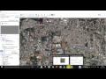 Download Very High Resolution Georeferenced Satellite Image
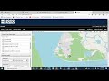 How to Download High Resolution Satellite Image from USGS (Glovis) Portal
 OSINT At Home #9 – My Top 4 Free Satellite Imagery Sources
 How to get the most current satellite imagery
 Downloading satellite data from USGS websites
 How to download Satellite Images from the USGS, ESA and Google Earth Engine
 Downloading Landsat 8 satellite image data to use in a GIS
 Get High Quality Images from Google Earth Tutorial
 Estimating Lake Area Expansion Using NDWI for understanding changes and effects.
 Landsat 8 Image Classification with ArcGIS (Supervised)
 Downloading Sentinel Imagery Via Copernicus Open Access Hub
 How to Buy Satellite Images With SkyWatch's EarthCache
 Downloading Digital Elevation Data (SRTM) from USGS EarthExplorer
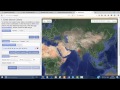 How to download Landsat 8 or any satellite data from USGS Earth explorer
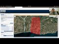 Downloading data from the USGS Earthexplorer
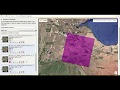 Download Landsat Image from EarthExplorer
 Landuse classification of Sentinel 2A, L-8 & L-7 image in ArcGIS | A complete guide on LULC
 HOW TO DOWNLOAD LANDSAT 8 IMAGE FROM USGS EARTH EXPLORER WEBSITE
 Lesson 2 - Downloading Free IRS Satellite Data from Bhuvan