Lesson 2 - Downloading Free IRS Satellite Data from Bhuvan
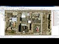
This lesson by Professor Chinmaya S Rathore demonstrates how to download free Indian Remote Sensing Satellite Imagery for India from the Open Data Archive at the Bhuvan Geoportal.
Link to Bhuvan Site
http://bhuvan.nrsc.gov.in/bhuvan_links.php
Visit the PRIMEWIN course page at https://goo.gl/BXcQ1Y
Видео Lesson 2 - Downloading Free IRS Satellite Data from Bhuvan канала Dr. Chinmaya S Rathore Tutorial Videos
Link to Bhuvan Site
http://bhuvan.nrsc.gov.in/bhuvan_links.php
Visit the PRIMEWIN course page at https://goo.gl/BXcQ1Y
Видео Lesson 2 - Downloading Free IRS Satellite Data from Bhuvan канала Dr. Chinmaya S Rathore Tutorial Videos
Показать
Комментарии отсутствуют
Информация о видео
21 декабря 2016 г. 12:23:26
00:10:36
Другие видео канала
 Download very high resolution satellite image 0.3 metre for free
 ISRO Bhuvan Geoportal (इसरो भुवन जियो-पोर्टल)-Tools and Services (Demonstrations) in Hindi
 Download High Resolution Satellite Images USGS 2017 (Updated)
 An Absolute Beginner's Guide to QGIS 3
 COMPOSITE BANDS OR LAYER STACK BY ARC GIS 10.3
 How to Pull Images from Satellites in Orbit (NOAA 15,18,19 and METEOR M2)
 CMIP6 Data Download | Download from ESGF | What is CMIP6
 How to download Satellite Data from BHUVAN Geoportal
![How To Create Animation Scene in LibreOffice Impress - Easy Method [Animation Tutorial]](https://i.ytimg.com/vi/Ev4DDKLU4YQ/default.jpg) How To Create Animation Scene in LibreOffice Impress - Easy Method [Animation Tutorial]
How To Create Animation Scene in LibreOffice Impress - Easy Method [Animation Tutorial] High Voltage Transmission Line Drawing with Google Map
 How to do Landslide Analysis in Arcgis? || ArcGIS || 10.2.2 || @GeoTech Studio
 R language tip: Create maps in R
 Crop Yield Estimation from Satellite for Tropical Agriculture
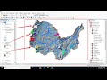 Hydrological modeling in ArcGIS / ArcMap
 How to download Satellite Data/Images(Cartosat-1) from ISRO Bhuvan Geoportal
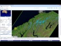 How to download Landsat data from GLOVIS
 LibreOffice Math: Spacing in a formula or equation
 QGIS Field Calculator Basics
 Download Thematic Map Layer from Bhuvan || Download Geomorphology, LULC, Liniment Map from Bhuvan
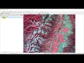 Download Landsat 8 Data for Free