How to download Satellite Images from the USGS, ESA and Google Earth Engine
This tutorial showcases different options for downloading satellite data (Landsat 8, Sentinel 2 and SRTM) from different sources.
I explain how to use the USGS Earth Explorer to search for different datasets and download Landsat 8 Level-1 and Level-2 data, give an overview on the Copernicus Hub which provides open access to data from the Sentinel missions, and finally I have a short introduction on how to download satellite data from Google Earth Engine. Google Earth Engine is my favorite source for satellite data, as you can directly clip your scene and select different bands within the Earth Engine coding environment. This way you don't have to download huge scenes when you only need a small snippet of it.
USGS Earth Explorer: https://earthexplorer.usgs.gov/
Copernicus Open Access Hub: https://scihub.copernicus.eu/
Google Earth Engine: https://earthengine.google.com/
Chapters:
0:00 Introduction
1:22 USGS Earth Explorer
6:22 Copernicus Open Access Hub
8:48 Google Earth Engine
Earth Engine Code for Sentinel 2:
var s2 = ee.ImageCollection('COPERNICUS/S2') // Level-C1 (TOA), for Level-2A (BOA) use 'COPERNICUS/S2_SR'
.filterBounds(geometry)
.filter(ee.Filter.lessThanOrEquals('CLOUDY_PIXEL_PERCENTAGE', 10))
.filter(ee.Filter.date('2020-05-01', '2020-05-31'))
var clip_all = function(img){
return img.clip(geometry)
}
var s2_clip = s2.map(clip_all)
var s2_list = s2_clip.toList(s2_clip.size())
var n = s2_list.size().getInfo()
for (var i = 0; i \< n; i++){ //put an actual angled bracket here
var img = ee.Image(s2_list.get(i))
var rgb = img.select('B2','B3', 'B4').float()
var date = img.date().format('yyyyMMdd').getInfo()
Map.addLayer(img, {bands: ['B4', 'B3', 'B2'], max: 5048}, 'Image_'+date)
//export
Export.image.toDrive({
image: rgb,
description: 'Sentinel2_RGB'+ date,
scale: 10,
region: geometry,
folder: 'paris'
})
}
Видео How to download Satellite Images from the USGS, ESA and Google Earth Engine канала Making Sense Remotely
Показать
Комментарии отсутствуют
Информация о видео
Другие видео канала
 Google Earth Engine Tutorial: Sentinel 2 Cloud Masking and Export it to Google Drive
 Download High Resolution Satellite Images USGS 2017 (Updated)
 Exporting images from Google Earth Engine
 HOW TO CREATE ACCOUNT IN USGS EARTH EXPLORER & DOWNLOAD SATELLITE IMAGERY FREE
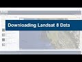 Downloading Landsat 8 satellite image data to use in a GIS
 An Absolute Beginner's Guide to QGIS 3
 7. Download Satellite Images inside QGIS
 NASA ARSET: Monitoring Flood Extent with Google Earth Engine, Part 1/2
 Download very high resolution satellite image 0.3 metre for free
 Supervised Classification with Sentinel 2 Satellite Images | Google Earth Engine | Machine Learning
 Downloading satellite data from USGS websites
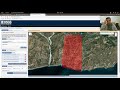 Downloading data from the USGS Earthexplorer
 Trick to download Google earth image and georeference it
 Google Earth Advanced Tools Tutorial
 Landsat 8 Image Classification using QGIS
 Downloading Landsat 8 images from USGS EarthExplorer
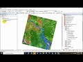 NDVI | Vegetation/Forest Cover Map in ArcGIS
 Google Earth Pro - A Complete Beginner’s Guide
 Landsat 8 Image Classification with ArcGIS (Supervised)
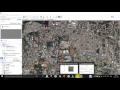 Download Very High Resolution Georeferenced Satellite Image