Satellite images in ArcMap - An Introduction
How to get started with using satellite images in ArcMap, including loading individual Landsat 7 ETM+ bands, creating a composite band image file, creating different band colour combinations, using the Image Analysis window, creating an NDVI image, loading a thermal band image, and using the Swipe tool
Data was obtained from GeoGratis: http://geogratis.cgdi.gc.ca/geogratis/en/download/satellite.html
Видео Satellite images in ArcMap - An Introduction канала Don Boyes
Data was obtained from GeoGratis: http://geogratis.cgdi.gc.ca/geogratis/en/download/satellite.html
Видео Satellite images in ArcMap - An Introduction канала Don Boyes
Показать
Комментарии отсутствуют
Информация о видео
Другие видео канала
 Downloading Landsat 8 satellite image data to use in a GIS
 Landsat 8 Image Classification with ArcGIS (Supervised)
 A Complete Beginner's Guide to ArcGIS Desktop (Part 1)
 Digitizing in ArcMap
 When deep learning meets satellite imagery
 How to Georeference an Image or a Scanned Map using ArcMap
 Spoken English Lecture - 1 English as a language | How to speak English faster | Learn like native
 How to Mosaic or Merge Raster Datasets | Remove Background value | Mosaic satellite images in ArcGIS
 Extracting Stream or Drainage Network from DEM
 Tutorial 3: Basic Image Analysis tools for Beginners in ArcGIS
 Google Earth Engine 101: An Introduction for Complete Beginners
 How to composite bands in ArcGIS | Pan Sharpening Imagery in ArcMap
 Supervised Image Classification in ArcGIS Desktop - ArcMap
 Downloading free USGS DEM data (digital elevation model) for use in a GIS
 Geogr 66, Lesson 1A: Introduction to Creating a Web Map in AGOL
 Natural neighbour for creating a surface from sample points
 Downloading Landsat 8 images from USGS EarthExplorer
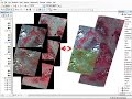 mosaic raster dataset Landsat ArcGis
 Watershed Delineation using Hydrology Tool in ArcGIS
 ArcGIS 10 - № 23. Классификация и перевод в вектор