ArcMap 10.2: Zonal Statistics
The ArcMap Zonal Statistics tools was used to calculate several statistics of each zone within the dataset to better understand the study area and help to make better decisions for further analysis.
Видео ArcMap 10.2: Zonal Statistics канала Usman Buhari
Видео ArcMap 10.2: Zonal Statistics канала Usman Buhari
Показать
Комментарии отсутствуют
Информация о видео
Другие видео канала
 Zonal Statistics and Zonal Statistics as a Table
 Zonal statistics in ArcGis
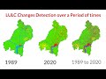 Land use/Land cover Change detection Analysis for an Area over a certain timeline like 1989 to 2020
 Reclassify & Convert Raster to Shapefile ( Polygon) & Calculate Area Using ArcGIS
 Georeferencing in ArcMap Tutorial
 Zonal Statistics and Landcover data
 Block, zonal, and focal statistics
 ArcMap 10.2: Drainage Density Map
 Regressing in ArcGis
 Global, zonal, and focal statistics lecture (NCSU Geospatial Modeling and Analysis)
 How to create contour lines in ArcMap?
 Slope Analysis from DEM in ArcGIS || Slope-Wise Area Calculation || @GeoTech Studio
 Land Surface Temperature (LST) : Atmospheric Correction of Landsat dataset - Step 2
 Hydrologic Modeling Using HEC-HMS (5/9) - Assigning CN to sub-basins
 NDVI and LST index correlation using ArcGIS 10.3
 GIS Tutorial | Part 7 | How to create elevation map for any region | Tutorial for Beginners | ArcGIS
 How to make a landuse and landcover map in arcgis
 Landsat 8: Atmospheric Correction and Band Rationing Using ArcGIS
 How to type in an XY Location to find it in ArcGIS
 Lecture : 8 |ArcGIS 10: Basic Spatial Analysis