MAJOR UPDATE - Colder, Thunderstorms & Significant Snow
DRASTIC CHANGES COMING
Bakersfield had a high of 82° Wednesday. That was the warmest day of 2024, so far! That all changes today, as we drop a good 20-25°; upper 50s. Temperatures fall even further Friday; mid to the mid 50s. A cold low pressure system dives in from the cold waters western Washington and Oregon. This will not be like the recent Winter Storm #7, but this "cold storm" won't be significant in damage, but can carry lower snow levels and potential isolated thunderstorms.
WINTER STORM CONDITIONS
A Winter Weather Advisory has been posted from 5 PM today to 11 PM Friday. 1-2" of snow is forecast above 3,000' (including the major passes) and 2-6" above 5,000'. As is the case with most cold storms, there is no connection to any rich moisture source- so no excessive amounts of rainfall or snow. The cold air, however can create isolated thunderstorms by Friday. A quarter-inch of hail will be possible. Rainfall amounts will likely range from .10-.25" for the South Valley; .25-.50" in our Kern County mountain areas.
WINDY OUTLOOK
A Wind Advisory holds for the Kern County desert from 1 PM today - 5 AM Friday. Southwest gusts near 55 MPH. Blowing dust is likely, but also strong winds will be a part of the whole county. The South Valley could have winds around 25 MPH this afternoon. The Kern County mountains will range from 30-55 MPH. Do not discount them.
Видео MAJOR UPDATE - Colder, Thunderstorms & Significant Snow канала Aaron Perlman
Показать
Комментарии отсутствуют
Информация о видео
Другие видео канала
 HEAT ADVISORY - One More Day!
 Heat Advisory Coming (Tuesday - Thursday)
 Star Wars Forecast - How Many Star Wars References Can You County
 It's Your Birthday
 Weatherman VS Spider #acrossthespiderverse #weather #spider
 HOUCHIN HEARTBEATS: Houchin Blood Bank's First Student Spokesperson Hallie Keese
 Free Comic Book Day Rap: The Sequel preview
 WebMD Chief Medical Dr. Explains Says Heart Disease Affects Black Americans More
 Return Of The Jedi Producer, Howard Kazanjian, Talks 40 Year Anniversary
 WEEKEND FORECAST - Hanukkah and Christmas Week Turns Mild; 60s. Fog Possible. (December 12, 2022)
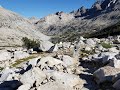 Hiking the John Muir Trail 2021 - Day 9: Mather Pass to Le Conte Canyon
 Winter Ends & Spring Begins (Weather Forecast)
 Give Me 4-More Days Of The Heat
 Pre-Thanksgiving Forecast with Possible Rain Monday
 Christmas Night
 Weekend Forecast Brings 70s & Rain for the Kern Mountains (October 5th, 2018)
 "Atmospheric River" - Flood Watch & Winter Storm Warning
 Weatherman Tries the "Elaine Dance" from Seinfeld
 Windy and Chilly Monday / Rain Returns Thursday Night (Monday, November 28th, 2022)
 Don't Expect Triple Digits For A While
 Hiking the John Muir Trail 2021 - Day 5: Tyndall Creek to Onion Valley