Windy and Chilly Monday / Rain Returns Thursday Night (Monday, November 28th, 2022)
A Wind Advisory starts our weather forecast this Monday. Westerly gusts up to 50 MPH forecast from 10 AM - 10 PM for our mountain and desert areas. Expect 15 - 25 MPH winds during that same timeframe. It will be breezy in the Bakersfield area by the lunch hour. This will help clear out a lot of our haze by tomorrow. Air quality today is in the poor range; unhealthy for sensitive groups. Skies become partly cloudy as pile-up clouds develop overnight for the Bakersfield area. Skies should clear Tuesday midday into Tuesday night. The cold air driven by the passing cold front, pushing in our strong winds, creates a Freeze Watch Tuesday night into Wednesday morning. Temperatures will range from 28 to 32゚. Afternoon highs the next few days are in the upper 50s to low 60s.
The passing cold front today into tomorrow will not bring any rainfall. However, showers are expected to return Thursday night into Sunday. A series of storms roll in out of the Northwest and Canada. The first storm comes through Thursday evening. It will bring showers out of the Southwest first off, then we'll see rain come out of the Northwest Friday morning. A break in the system comes Saturday into Saturday night. That is when colder air and rainfall returns Saturday evening into Sunday. Bakersfield could see up to a .25-.50" rainfall. Mountain areas could see over an inch of rainfall. Snow levels stay slightly above 4,500'.
Видео Windy and Chilly Monday / Rain Returns Thursday Night (Monday, November 28th, 2022) канала Aaron Perlman
Показать
Комментарии отсутствуют
Информация о видео
Другие видео канала
 Star Wars Forecast - How Many Star Wars References Can You County
 It's Your Birthday
 Weatherman VS Spider #acrossthespiderverse #weather #spider
 HOUCHIN HEARTBEATS: Houchin Blood Bank's First Student Spokesperson Hallie Keese
 Free Comic Book Day Rap: The Sequel preview
 WebMD Chief Medical Dr. Explains Says Heart Disease Affects Black Americans More
 Return Of The Jedi Producer, Howard Kazanjian, Talks 40 Year Anniversary
 WEEKEND FORECAST - Hanukkah and Christmas Week Turns Mild; 60s. Fog Possible. (December 12, 2022)
 Hiking the John Muir Trail 2021 - Day 9: Mather Pass to Le Conte Canyon
 Winter Ends & Spring Begins (Weather Forecast)
 Give Me 4-More Days Of The Heat
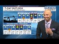 Pre-Thanksgiving Forecast with Possible Rain Monday
 Christmas Night
 Weekend Forecast Brings 70s & Rain for the Kern Mountains (October 5th, 2018)
 "Atmospheric River" - Flood Watch & Winter Storm Warning
 Weatherman Tries the "Elaine Dance" from Seinfeld
 Don't Expect Triple Digits For A While
 Hiking the John Muir Trail 2021 - Day 5: Tyndall Creek to Onion Valley
 Congressman Kevin McCarthy Gives The Forecast
 Biblecast