Adding a Google Earth Image to AutoCAD (and Georeferencing)
In this video, you will learn how to add a high-resolution image from Google Earth to AutoCAD, and how to georeference the image using two reference points within AutoCAD.
⭐NOTE:
‘Kite’ is an excellent tool that can help you boost your productivity when it comes to programming with its free Artificial Intelligence (AI) powered coding assistant. Kite is a plugin which provides smart completions and documentation as you’re typing-in your code, and its compatible with most of the well-known IDEs such as PyCharm, Spyder and VS Code. I absolutely love it, and recommend you guys to try it out as well.
https://www.kite.com/get-kite/?utm_medium=referral&utm_source=youtube&utm_campaign=geodelta&utm_content=description-only
Видео Adding a Google Earth Image to AutoCAD (and Georeferencing) канала GeoDelta Labs
Показать
Комментарии отсутствуют
Информация о видео
Другие видео канала
 INSERTING GOOGLE EARTH IMAGE TO AUTOCAD | MAKE SITE PLAN IN AUTOCAD USING GOOGLE EARTH
 Most easy way to EXTRACT CONTOURS from GOOGLE EARTH directly in AUTO CAD using GLOBAL MAPPER
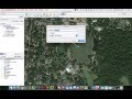 Inserting and Scaling Aerial Images in AutoCAD
 Export Coordinates from Google Earth to Excel
 Extracting Elevation Data from Google Earth
 Trick to download Google earth image and georeference it
 Google Earth Image Overlay in AutoCAD
 How to Export AutoCAD Drawing to Google-Earth
 AutoCAD Tutorial; Insert, georeference google earth image
 Google Earth Pro - A Complete Beginner’s Guide
 How to import x,y,z coordinate from Excel to AutoCAD
 Extract Coordinates (Lat/Long) from Google Earth Pro | then export to UTM
 Autocad 2018 - How to draw a Location Site Plan
 An Absolute Beginner's Guide to QGIS 3
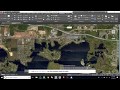 AutoCad Tutorial | Site Plans using Geolocation
 Google Earth Pro Advanced Tutorial (Part 1)
 How to extract contour lines And DEM from Google Earth
 How to import X Y coordinates from Excel to AutoCAD direct! (English)
 AutoCAD to KML / AutoCAD to Google Earth