AutoCAD Tutorial; Insert, georeference google earth image
** AutoCAD Productivity Training Webinar Available Now: https://gumroad.com/l/oPLLa **
I made a new updated video showing a better method to bring in google earth images, check it out here: https://youtu.be/YrFDMfyRl1k - UPDATED VIDEO
Sign up for Updates and Free Downloads: http://cadintentions.com/signup
Download AutoCAD Templates: http://cadintentions.com/tbdl
Learn Civil 3D (C3D Crash Course): http://cadintentions.com/c3dcc
Learn AutoCAD (ACAD Courses): http://cadintentions.com/courses
Twitter: http://twitter.com/cadintentions
My Gear/Recommendations
AutoCAD 2018: http://bit.ly/2ouIOXX
PC: http://cadintentions.com/xi
Cool Monitor x2: http://amzn.to/2n4YS2l
Mouse: http://amzn.to/2n55JZE
KeyBoard: http://amzn.to/2n514XL
Pencils: http://amzn.to/2nPT61L
Sketch/Notebook: http://amzn.to/2nBTqjH
Headphones: http://amzn.to/2n5nmsn
AutoCAD Tutorial: Insert, georeference google earth image
In this video I go over how to insert georeference a google earth image in autocad, I also insert property lines from a city website. I explain how to do this using the align command in CAD
As always don't forget to subscribe, and if you have any questions don't hesitate to ask!
Cheers and thanks for watching
Get 2 Free Autocad Title Blocks: http://cadintentions.com/signup .
**Have I helped you out? Consider supporting CAD Intentions on Patreon: https://www.patreon.com/cadintentions
Видео AutoCAD Tutorial; Insert, georeference google earth image канала CAD Intentions w/Brandon
Показать
Комментарии отсутствуют
Информация о видео
24 января 2012 г. 13:14:51
00:07:23
Другие видео канала
 Adding a Google Earth Image to AutoCAD (and Georeferencing)
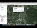 Inserting and Scaling Aerial Images in AutoCAD
 Successfully insert Georeferenced Orthophotography in AutoCAD Civil 3D
 AutoCAD: Insert and Scale an Image to Trace
 How to georeference maps in Google Earth
 QGIS Georeferencing Google Earth Images
 All about using maps in AutoCAD
 AutoCAD Tutorial - The power of the XREF!
 Video Tutorial 010 Autocad Scale Google Earth for Site Plan
 18 Places Google Earth Doesn't Want You to See
 Google Earth Engine in QGIS - QGIS GEE 01 | burdGIS
 AutoCad LT 2021 GeoReference
 Google Earth Advanced Tools Tutorial
 50 strange things on Google earth
 Georeferencing a drawing in AutoCAD
 INSERTING GOOGLE EARTH IMAGE TO AUTOCAD | MAKE SITE PLAN IN AUTOCAD USING GOOGLE EARTH
 AutoCAD How to INSERT & SCALE an Image for TRACING! | 2 Minute Tuesday
 Georeferenzieren mit QGIS Komplettes Tutorial
 How to import x,y,z coordinate from Excel to AutoCAD