All about using maps in AutoCAD
In this video I have explained the following topics:
Learn AutoCAD with full-length video courses on SourceCAD, start your 7-day free trial https://thesourcecad.com/courses/
1. Using geolocation to Insert maps
2. Changing map type to aerial and street
3. Checking distances in the map
4. Making drawing using the map as an underlay
Видео All about using maps in AutoCAD канала SourceCAD
Показать
Комментарии отсутствуют
Информация о видео
Другие видео канала
 Autocad - Complete tutorial for beginners (Full tutorial 1h40m)
 Learn AutoCAD full Tutorial 2021 in Tamil
 INSERTING GOOGLE EARTH IMAGE TO AUTOCAD | MAKE SITE PLAN IN AUTOCAD USING GOOGLE EARTH
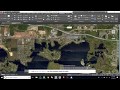 AutoCad Tutorial | Site Plans using Geolocation
 All about Data extraction in AutoCAD
 AutoCAD Basic Tutorial for Beginners - Part 1 of 3
 How to import x,y,z coordinate from Excel to AutoCAD
 AutoCAD page setup in layout or paper space
 Import OpenStreetMap data into AutoCAD drawings - Spatial Manager Blog
 Google Earth Master Plan in Photoshop
 How bad is a $95 3D Printer??
![Google Earth Master Plan in Photoshop [ Quickest Method ]](https://i.ytimg.com/vi/vYd9OhHCDuM/default.jpg) Google Earth Master Plan in Photoshop [ Quickest Method ]
Google Earth Master Plan in Photoshop [ Quickest Method ] How to: PLOT PROPERTY BEARINGS in AutoCAD 2020
 GeoLocation in AutoCAD | Google Map overlay in AutoCAD | Online Satellite Map in AutoCAD
 How to Create a Property Map with Google Maps
 Tutorial 301 Vicinity Map Tracing
 AutoCAD Map 3D for Engineers
 How to create title block and its template in AutoCAD - Part 2 of 2
 How to use proper scale in AutoCAD drawings - Part 1 of 2
 Autocad 2018 - How to draw a Location Site Plan