ArcGIS Tutorial # 6 | How to download satellite image | Geospatial Raster data
this video introduces you with a site from where you can download freely available satellite data like DEM (Digital Elevation Model) data, Landsat imagery, Sentinel imagery, Land use Land cover and many more.
Link to the site is as mentioned below:
http://earthexplorer.usgs.gov/
#arcgistutorial #downloadsatellitedata #freeavailablesatellitedata #gisforbeginners #gis #arcgis
Видео ArcGIS Tutorial # 6 | How to download satellite image | Geospatial Raster data канала Geo Technocrats
Link to the site is as mentioned below:
http://earthexplorer.usgs.gov/
#arcgistutorial #downloadsatellitedata #freeavailablesatellitedata #gisforbeginners #gis #arcgis
Видео ArcGIS Tutorial # 6 | How to download satellite image | Geospatial Raster data канала Geo Technocrats
Показать
Комментарии отсутствуют
Информация о видео
Другие видео канала
 ArcGIS Tutorial # 7 | Download Image from Google Earth
 ArcGIS Tutorial # 9 | Download Geo-referenced High Resolution Google Earth Image
 How to download Satellite Images from the USGS, ESA and Google Earth Engine
 How to increase the resolution of landsat 8 OLI using ArcGIS
 Georeferencing an Image in ArcGIS Pro
 Shapefile download (Country, Road, River, forest cover, buildings, Land use) of any Location
 How to create buffer zone in ArcGIS | Buffer analysis in Urdu/Hindi || Lecture Number 28
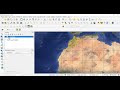 Tutorial N° 20 : Extract raster by QGis / Extraction des raster
 How to Download the Latest Land Use Land Cover (LULC) Data.
 Auto georeference aerial photo in ArcGIS | burdGIS
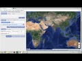 Downloading satellite data from USGS websites
 Descargar imágenes de Google Earth Pro 2020
 Download Facebook High Resolution Settlement & Population Raster Data for Urban Mapping
 Landsat 8 Image Classification using QGIS
 Free High Resolution Satellite Image 0.3m / 0.5m Download
 How to extract contour lines And DEM from Google Earth
 ArcGIS Tutorial # 11 | Image Subset
 How to Create 3D Maps with ArcGis and ArcScene!
 Landsat 8 Image Classification with ArcGIS (Supervised)
 Automatic digitizing on ArcGIS using ArcScan toolbar