How to Download the Latest Land Use Land Cover (LULC) Data.
This GIS Tutorial is about How to Download the Latest Land Use Land Cover Data !!
In this video, I have shown you the sources and steps to extract Landuse and Landcover (LULC) data for Gujarat State, Here you can download any state LULC data.
In general,
The MODIS Land Cover Type product is a global land cover classification data layer produced annually from 2001 to till Dec 2017.
For each year there are five land cover schemes, developed by different research groups. Data are distributed by the USGS at 500m resolution in standard MODIS grid tiles.
The following USGS site has detailed meta data and download access:
https://lpdaac.usgs.gov/dataset_discovery/modis/modis_products_table/mcd12q1
Here You create the Account in USGS & EARTHDATA (NASA)
EARTHDATA (NASA)- https://urs.earthdata.nasa.gov/home
USGS - https://earthexplorer.usgs.gov/
The MODIS Terra + Aqua Land Cover Type Yearly L3 Global 500 m SIN Grid product incorporates the following five different land cover classification schemes, each derived through a supervised decision-tree classification method:
Land Cover Type 1: IGBP global vegetation classification scheme
Land Cover Type 2: University of Maryland (UMD) scheme
Land Cover Type 3: MODIS-derived LAI/fPAR scheme
Land Cover Type 4: MODIS-derived Net Primary Production (NPP) scheme
Land Cover Type 5: Plant Functional Type (PFT) scheme
The five research groups developed their own classification schemes to categorize land cover properties using one year of Terra and Aqua MODIS data. The International Geosphere-Biosphere Programme (IGBP) Type 1 land cover scheme identifies 17 land cover classes (0 – 16) which include 11 natural vegetation classes, 3 developed and mosaicked land classes, and three non-vegetated land classes. Information about all of the data layers & Classes Pixel values / Classification or Grid codes For more information visit:
https://yceo.yale.edu/modis-land-cover-product-mcd12q1
Please subscribe for more videos!
🔔 Turn on notifications so you don't miss a new video! 🔔
For more videos please subscribe to this channel and you like the video then like it and comment it for any doubts or suggest new videos on another topic.
NOTE - (If you want more detail Classification like eg. Cropping Pattern, Forest, etc. then you need to do the GROUND TRUTHING for better result & Accuracy)
Music: www.bensound.com
Видео How to Download the Latest Land Use Land Cover (LULC) Data. канала GIS & REMOTE SENSING
Показать
Комментарии отсутствуют
Информация о видео
Другие видео канала
 Landsat 8 Image Classification with ArcGIS (Supervised)
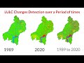 Land use/Land cover Change detection Analysis for an Area over a certain timeline like 1989 to 2020
 How to prepare soil map for the SWAT model
 LULC for India data Download and create shapefile
 Land Use Land Cover Map Download From Bhuvan NRSC Portal #ISRO #NRSC #BHUVAN #LULC
 Download Soil data and Prepare Soil Type Map in ArcGIS
 Shapefile download (Country, Road, River, forest cover, buildings, Land use) of any Location
 Land Use and Land Cover Change (LULC) Complete Tutorial
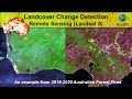 Landcover Change Detection using Landsat 8 (Australian Forest Fires 2019-2020)
 Landsat 8 Image Classification using QGIS
 Bhuvan Layer consume
 Google Earth Image and Land Cover Classification in ArcGIS || Supervised and Unsupervised
 Download free soil data and create a soil map layout on ArcGIS
 How to Download the Latest Land Use Land Cover (LULC) Data
 Watershed Delineation in ArcGIS | How to create Drainage Map
 How to Download (GIS) Data for Any Country Especially Shapefile (Boundaries) and DEM
 Unsupervised Classification of a satellite image using ArcGIS
 Climate Data (Temperature, Precipitation, Humidity) from 1981-2020
 Download Thematic Map Layer from Bhuvan || Download Geomorphology, LULC, Liniment Map from Bhuvan
 Downloading Landsat 8 satellite image data to use in a GIS