How to Download (GIS) Data for Any Country Especially Shapefile (Boundaries) and DEM
How to download free geographic (GIS) data for any country in the world especially shapefile and stream network and Dem.
Did you subscribe my YouTube channel? If it's no, Do it right now with only one click. Thank you for your support.
http://www.diva-gis.org/gdata
#SharingisCaring
#PleaseSubscribe
Check this link to watch similar videos: https://www.youtube.com/user/fitsalem/videos?view_as=subscriber
Видео How to Download (GIS) Data for Any Country Especially Shapefile (Boundaries) and DEM канала Tech-tutor with Fitsum
Показать
Комментарии отсутствуют
Информация о видео
Другие видео канала
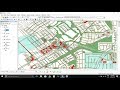 How to download Shapefile Data GIS for any country
 Download Satellite Images and DEM for Free
 STUDY AREA Mapping
 Shapefile download (Country, Road, River, forest cover, buildings, Land use) of any Location
 Shapefile from Google Earth to GIS || Importing Image from Google Earth to GIS
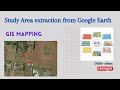 Study Area extraction from Google Earth and Export in ArcMap
 How to Download Geological data shape file for any Country
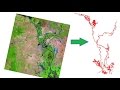 How to extract River shape from Landsat Image
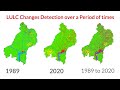 Land use/Land cover Change detection Analysis for an Area over a certain timeline like 1989 to 2020
 Top 5 data sources to download spatial data | Download shapefiles for GIS mapping | GIS Tutorial
 How to download Openstreetmap data in shapefile (GIS) for any Country
 How to Download ASTER DEM 30m Data for FREE
 A Complete Beginner's Guide to ArcGIS Desktop (Part 1)
 An Absolute Beginner's Guide to QGIS 3
 Download very high resolution satellite image 0.3 metre for free
 Download Shapefile For Any Country - Free
 How to Download TRMM Precipitation Data and Estimate Erosivity Factor in ArcMap
 How to make a study area on ARC GIS in Amharic በ ARCGIS ላይ የጥናት ቦታ እንዴት እንደሚሰራ
 How to use a DEM to delineate a Watershed/Basin in ArcGIS