Landsat 8 Band Combinations in ArcGIS Pro
In this video I illustrate different band combinations of Landsat 8
For the video on Adding Raster Data to ArcGIS Pro, Find the link Here:
https://youtu.be/2jySZ-oCIgY
📺 Subscribe To My Channel and Get More Great Content: https://www.youtube.com/channel/UCdHn...
🕰SCHEDULE
Videos are uploaded every week. Make sure to Subscribe and hit the Notification bell to be notified when videos go live.
👤Connect with me:
https://www.linkedin.com/in/wencelaus...
https://www.facebook.com/wencelaus.na...
https://www.instagram.com/wencelaussi...
https://twitter.com/wencelaussimiyu
Discover ArcGIS Pro: https://bit.ly/2FqwA9q
ArcGIS Pro Free Trial: https://bit.ly/2QPfpUk
Resources
Landsat 8 Bands:
https://landsat.gsfc.nasa.gov/landsat-8/landsat-8-bands/
Band Combinations:
https://www.harrisgeospatial.com/Learn/Blogs/Blog-Details/ArtMID/10198/ArticleID/15691/The-Many-Band-Combinations-of-Landsat-8
Видео Landsat 8 Band Combinations in ArcGIS Pro канала Wencelaus Simiyu
Показать
Комментарии отсутствуют
Информация о видео
Другие видео канала
 Landsat 8 Image Classification with ArcGIS (Supervised)
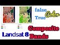 Composite Landsat 8 bands
 ArcGIS Pro: Analysis Overview
 Sentinel and Landsat data processing in ArcGIS Pro
 Download Dem or landsat data from Google Earth Explorer USGS
 Merging and Dissolving in ArcGIS Pro
 Band Ratios in Remote Sensing (Class 2 - V3)
 Procesamiento de imágenes satelitales con ArcGIS Pro
 Creating a Band Ratio Composite in QGIS 3.10 (Lab 2 - V3)
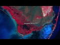 Landsat 8: Band by Band
 Downloading Using and Analyzing Lidar Data in ArcGIS Pro
 ArcGis 3d analyst Draping an image over a terrain surface
 Taller: Clasificación de imágenes satelitales en ArcGis Pro
 Prepare Study Area Map Easily |QGIS
 Delimitar una cuenca hidrográfica en ArcGIS
 Calculating Land Surface Temperature (LST) of Landsat 7 and Landsat 5 | ArcGIS Tutorial
 Downloading data from the USGS Earthexplorer
 Calcule l'indice NDVI en ArcGis حساب مؤشر الاخضرار النباتي
 ArcGIS Pro: Machine Learning Classification for Impervious Surfaces
 Working with Landsat imagery in ArcGIS Pro