How to Download FREE Satellite Images in 2020 - Ep 113 Sailing Luckyfish
How to Download FREE Satellite Images in 2020 using SAS Planet and load them into OpenCPN in 5 minutes!
All the links you need are below. And, you can copy the text summary to use as a reference.
Many thanks to all the contributors for creating these open source tools.
01:11 INSTALL THE SOFTWARE (Links Below)
Firstly, install open CPN. Now go to SAS Planet in the link provided and download the zip file. Find the file and downloads, right click and extract to your root directory. You don't install SAS planet and state. Copy the executable and send to your desktop. Double click the icon to open and scroll through the list of imagery available. SAS planet has done all the work for you. Linking to Google maps, Google satellite images, satellite images from Bing sonar charts from Navionics and many more.
02:02 SELECT BEST IMAGERY
Move to your area of interest and choose what imagery gives you the best detail zoom in and find the limit where no more detail is offered. 02:20:18 -- 02:36:27 3. FIND THE ZOOM LIMIT The zoom limit is shown in the bottom left hand corner. I find 18 is about the limit for satellite imagery, zoom out and choose a broader zoom level. For general scale viewing 14 works pretty well.
02:37 SELECT YOUR AREA
Now I go to operations selection manager and select polygonal selection. Click the battery of the area of interest and click the green checkbox to finish. 02:54:13 -- 03:11:25 5. DOWNLOAD THE DATA Now with selection manager, open on the download tab, select zoom levels, 14 and 18. Make sure your map overlay is set to the imagery you chose in this case. Bing satellite maps and click start.
03:19 EXPORT MBTiles FILE
Now, we need to export this cashed image as an MBTile file. This is a high resolution geo referenced database that open CPN can read, go to operations, selection manager and select last selection. Open the export tab. Choose the MB tiles. 1.2 option. Go to the save to box and choose the directory where you store your charts. Check the zoom levels you used previously. Leave everything else on the defaults and click start the export. Doesn't take long.
04:12 LOAD NEW IMAGE INTO OpenCPN
We're almost there. Now start OpenCPN go to options and main chats. Add the directory. You just stored your MB tile file. If the directory is not already there, click scan charts and update database, click apply and vain. Okay. You will see a red box outlining the satellite images. You just installed. Select the image layer to view your new satellite imagery, zoom in to see firstly, your 14 level zoom. And then you are 18 levels. Zoom pan around to confirm you have what you expected.
Links:
Download OpenCPN here: https://opencpn.org/OpenCPN/info/downloadopencpn.html
Download SASPlanet here: http://gdayii.ca/Downloads/Sasplanet.zip
Good overview and history here: https://www.sail-worldcruising.com/news/225719/Mbtiles-for-OpenCPN
MUSIC CREDIT
05:03 Tatono - Revolving Feeling https://soundcloud.com/tatono/revolving-feeling
Видео How to Download FREE Satellite Images in 2020 - Ep 113 Sailing Luckyfish канала Sailing Luckyfish
Показать
Комментарии отсутствуют
Информация о видео
Другие видео канала
 Ultimate Bug Out Vehicle? We found it! - Ep 112 Sailing Luckyfish
 OSINT At Home #9 – My Top 4 Free Satellite Imagery Sources
 Handmade Chocolate Making by a Mayan Master - Ep 114 Sailing Luckyfish
 18 Places Google Earth Doesn't Want You to See
 Wharram Pahi 42 Project Boat Tour & Update from Luckyfish - Ep 101 Sailing Luckyfish
 Download High Resolution Satellite Images USGS 2017 (Updated)
 Custom Maps using SAS Planet and Insight Map Creator for B&G, Lowrance, SIMRAD chartplotters
 Openplotter instruction video for Raspberry Pi
 Catch Clean & Cook Lobster & Crab the Belizean Way - Ep 120 Sailing Luckyfish
 So Long and Thanks for all the FISH - Ep 17 Sailing Luckyfish
 4. OpenCPN : Installation de cartes.
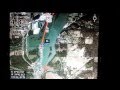 Make your own maps for Lowrance HDS
 Ep.71 How to easily create an animated map for your sailing videos - Carl and Jenny
 5 REASONS i want to be a SAILOR ! | NEW CREW - Ep 107 Sailing Luckyfish
 تحميل مرئيات فضائية مصححة عالية الجودة بالإحداثيات الجغرافية
 Going CUCKOO in Self-Isolation - Ep 117 Sailing Luckyfish
 How We Get Internet Sailing the World (wifi, phone & satellite)
 CRAZY SIMPLE SAILING RIG - Secrets of the Wharram Wingsail - Ep 104 Sailing Luckyfish
 SAILBOAT TECH: Satellite communication solutions for offshore sailing // Ryan's Tech Corner #13