RUS Webinar: Crop mapping with Sentinel-2 - LAND01
You will learn the basics of image processing for crop mapping: we will show you how to access the RUS Service and how to download, process, analyse and visualise the free data acquired by the Copernicus satellites.
We will employ the ESA SNAP Sentinel-2 Toolbox to demonstrate the crop mapping methodology over the agricultural area of the Guadalquivir Marshes near Seville, Spain.
CHALLENGE YOURSELF with our E-Learning courses available on the RUS training platform: https://rus-training.eu/course
Follow the remote sensing theory courses explained by our experts and test your knowledge through the online questions at the end of each video!
Видео RUS Webinar: Crop mapping with Sentinel-2 - LAND01 канала RUS Copernicus Training
Показать
Комментарии отсутствуют
Информация о видео
Другие видео канала
 Meha Jain - A Scalable Satellite-based Crop Yield Mapper
 RUS Webinar: Earthquake deformation with Sentinel-1 - HAZA05
 NDVI from Sentinel-2 in SNAP
 ESA Echoes in Space - Land: Crop type mapping with Sentinel-1
 Using AI & Machine Learning to transform geospatial data into actionable insights | Jimi Crawford
 RUS webinar: Copernicus Data Access: SciHub & DIAS platforms
 RUS webinar: Vegetation monitoring for Agriculture with Sentinel-2 - LAND11
 Methods for cropland/crop type mapping from S2 and/or S1 time series - Day 2.2
 ESA Echoes in Space - Hazard: Flood mapping with Sentinel-1
 Downloading and preprocessing Sentinel 2 images using the Semi-Classification Plugin in QGIS 3.0
 RUS webinar: Volcano Monitoring with Sentinel-1 - HAZA10
 Crop Yield Estimation from Satellite for Tropical Agriculture
 Landsat 8 Image Classification with ArcGIS (Supervised)
 ESA Echoes in Space - Water: Water Body Mapping with Sentinel-1
 RUS Demo: Land Subsidence mapping using Sentinel-1
 RUS Webinar: Land Subsidence mapping with Sentinel-1 - HAZA03
 mosaicing, subsetting and masking raster datasets in SNAP
 QGIS 4 Arch - Satellite Remote Sensing with Sentinel-2 (SCP, NDVI, Band Combos, Raster Calculator)
 RUS Webinar: Air quality monitoring with Sentinel-5p - ATMO01
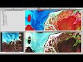 Exploring Sentinel-2 multi-spectral band combinations in SNAP