Carshalton Walk: Town Centre【4K】
Located within Greater London, and around 11 miles south of central London, is the town of Carshalton.
The area referred to as Carshalton consists of multiple distinct parts, including Carshalton Village, Carshalton Beeches and Carshalton on the Hill. The focus of this walk is Carshalton Village, which is its historic centre.
Carshalton has been home to a community of Christian worship for over 1,000 years. The Church of All Saints features a tower believed to be of Norman origin, although much of the church was built between 1890 and 1913 when it was extended. It is situated directly adjacent to Carshalton Ponds, which form part of the source of the River Wandle and feature prominently in the walk.
Outside the churchyard wall is a spring known as Anne Boleyn's Well. According to legend, a blow from the hoof of Anne Boleyn's horse caused a spring to rise, although another theory suggests that its origin lies with the Count of Boulogne, who was lord of the manor in the 12th century. As such, there may have been a chapel dedicated to Our Lady of Boulogne in the vicinity. Either way, the well is now dry.
Other notable buildings in Carshalton include Honeywood Museum, also adjacent to Carshalton Ponds, and dedicated to local history; and the Water Tower, which dates from the early 18th century, situated in the grounds of Carshalton House, supplying it with piped water. Carshalton House refers to a former mansion just west of the tower, which has since become St Philomena's School.
In 1868 the railway arrived in Carshalton, although an earlier station by the name Carshalton preceded it, opening in 1847. This was in fact located in the neighbouring town of Wallington, and was renamed in 1868 to reflect this in conjunction with the opening of what is the current Carshalton station. An additional station opened in 1906 just under a mile to the south, initially named Beeches Halt, and later renamed Carshalton Beeches. Both stations are located in Travelcard Zone 5, making central London accessible by Oyster Card from here in about half an hour, although a potential money-saving option, depending on the destination, is to bypass Zone 1 and travel via Clapham Junction instead.
Historically, Carshalton was located within the county of Surrey up until 1965 with the formation of the ceremonial county of Greater London. Concurrently, the London Borough of Sutton was created, to which it belongs.
👇 SUBSCRIBE TO 4K EXPLORER FOR NEW VIDEOS EVERY WEEK 👇
https://www.youtube.com/4KExplorer?sub_confirmation=1
Filmed: 22nd October 2023
Link to the walk on Google Maps: https://maps.app.goo.gl/QMQpytoAn4AUr83y8
Filmed on a Sony FDR-AX700 with a Zhiyun Crane 2 and a Sony ECM-XYST1M Stereo Microphone.
TIMESTAMPS:
0:00 High Street
4:56 All Saints' Church
6:53 Church Hill
7:03 For the record, I DON'T recommend crossing here!
7:17 North Street
8:39 Honeywood Walk
14:40 Festival Walk
16:01 West Street
Видео Carshalton Walk: Town Centre【4K】 канала 4K Explorer
Показать
Комментарии отсутствуют
Информация о видео
Другие видео канала
 Leicester Walk: Outside King Power Stadium | Leicester City F.C.【4K】
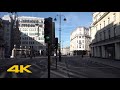 London's Most Beautiful Streets: Strand【4K】
 Cambridge Walk: City Centre【4K】
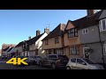 Baldock Walk: Town Centre【4K】
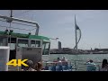 Riding the Gosport Ferry to Portsmouth | Full Crossing【4K】
 Burgess Hill Walk: Town Centre【4K】
 Saltburn-by-the-Sea Walk: Town Centre & Pier【4K】
 March Walk: Town Centre【4K】
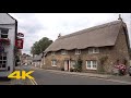 Oakham Walk: Town Centre【4K】
 Amersham Walk: Town Centre | Old Amersham【4K】
 Perth, Scotland Walk: City Centre【4K】
 London's Most Beautiful Streets: Onslow Square【4K】
 London's Most Beautiful Streets: Grafton Street【4K】
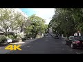 London's Most Beautiful Streets: Victoria Road【4K】
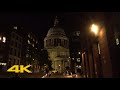 London Walk: St Paul's Cathedral at Night | via Millennium Bridge【4K】
 Sheffield Walk: City Centre【4K】
 Upminster Walk: Town Centre【4K】
 London Walk: Piccadilly Christmas Lights 2019【4K】
 Ascot Walk: Town Centre & Racecourse【4K】
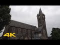 Neath Walk: Town Centre【4K】