Historic Lake-Effect Snow Radar Loop
This radar loop covers 5 days worth of lake-effect snow over the cities of Buffalo and Watertown NY from Dec 22,through Dec 26, 2022. Over 50" of snow fell in the Buffalo area, and over 40" in the Watertown area. Winds gusted over 50mph during this time as well, making for deadly white-out conditions.
Видео Historic Lake-Effect Snow Radar Loop канала Facethewind
Видео Historic Lake-Effect Snow Radar Loop канала Facethewind
Показать
Комментарии отсутствуют
Информация о видео
Другие видео канала
 Facethewind Live Stream
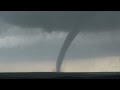 Tornadoes near McLean TX & Elk City OK - May 16 2017
 Nor'Easter "Gail" Dumps Over a Foot of Snow on Poughkeepsie NY
 Incredible tornadoes near Dodge City KS - May 24, 2016
 How to Measure Your Oil Tank Level Using a Simple Timer
 Hudson River Ice Flow - Winter 2011
 Tornado near Aurora NE - June 17 2009
 Tornado Simulation Chamber - Open Air Type
 Storm Chasing Roof Cam Construction
 "ThunderCold"
 Snowstorm & Traffic Nightmare - Poughkeepsie NY
 Motion Controlled Timelapse Compilation at Vassar College
 Tornadoes Near Waynoka, OK - May 18 2017
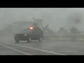 Hurricane Irma in SW Florida
 May 26 2014 - Large Hail Destroys Roof-Mounted Camera
 Yosemite & Death Valley Timelapse Collection
 Traxxas Nitro Jato - Wheelies & Crashes
 MHV Gem & Mineral Society 2012 Annual Show TV Coverage
 Baby Robins in Nest - 12 Days Old
 Heavy Lake Effect Snow & Wind in Watertown NY
 Supercell & Baseball Hail - May 29 2012