Tutorial: Land Cover Classification and Mosaic of Several Landsat images
This tutorial is about the land cover classification of several Landsat images in order to create a classification of a large study area using the Semi-Automatic Classification Plugin (SCP).
http://fromgistors.blogspot.com/2015/10/tutorial-land-cover-classification-and.html
SCP Website
http://fromgistors.blogspot.com/p/semi-automatic-classification-plugin.html
Facebook group of SCP
https://www.facebook.com/groups/SemiAutomaticClassificationPlugin
Google+ community of SCP
https://plus.google.com/communities/107833394986612468374
Landsat images available from the U.S. Geological Survey.
Music in this video:
Tutorial melody by Luca Congedo
under a Creative Commons Attribution-ShareAlike 4.0 International
Видео Tutorial: Land Cover Classification and Mosaic of Several Landsat images канала Luca Congedo
Показать
Комментарии отсутствуют
Информация о видео
Другие видео канала
 Know your Landsat: Understanding and Accessing Landsat Data
 Basic tutorial 1: Land Cover Classification of Landsat Images
 Tutorial: Land Cover Signature Classification
 Drone Deploy Mapping Demo Tutorial | DJI Mavic Pro
 Cloud Masking, Image Mosaic, and Land Cover Change Location
 How to mosaic multiple band in ArcMap | How to merges multiple band in ArcGIS
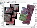 mosaic raster dataset Landsat ArcGis
 Tutorial 1: Your First Land Cover Classification
 QGIS 4 Arch - Satellite Remote Sensing with Sentinel-2 (SCP, NDVI, Band Combos, Raster Calculator)
 Remote Sensing - Band Combinations
 Landsat 8 Image Classification with ArcGIS (Supervised)
 Postprocessing tools for assessing land cover change
 Calculate percentage of land use per subcatchment in QGIS 3
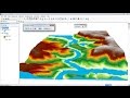 ArcGis 3d Analyst/ ArcScene Animation of flood
 Calculate NDVI with QGIS v3.4
 Downloading Landsat 8 satellite image data to use in a GIS
 Accuracy Assessment of a Land Cover Classification
 Supervised Classification of Sentinel-2 Images
 12 Urban Land Use Land Cover Classification
 Estimation of Land Surface Temperature with Landsat and ASTER