Calculating Normalized Difference Vegetation Index NDVI Using ENVI Classic
The normalized difference vegetation index is a simple graphical indicator that can be used to analyze remote sensing measurements, often from a space platform, assessing whether or not the target being observed contains live green vegetation.
Range: -1 to +1
Vegetated areas will generally yield high values for NDVI because of their relatively high NIR reflectance (0.7 - 1.1 μm) and low visible reflectance (0.58 - 0.68 μm)
NDVI shows as a high value for denser vegetation, while the NDVI is very low in desert, or non-vegetation regions
Видео Calculating Normalized Difference Vegetation Index NDVI Using ENVI Classic канала Muhammad Arshad
Показать
Комментарии отсутствуют
Информация о видео
Другие видео канала
 NDVI - Normalized Difference Vegetation Index
 How to Convert DN to At Sensor Brightness Temperature
 Calculate NDVI using ENVI Software
 Remote Sensing #18 - ENVI Sentinel 2, download, georeference, layer stack
 Normalized Difference Vegetation Index NDVI Geogrphic informations system ARCGIS - ESRI - GIS
 How to Convert Landsat 8 DN to TOA Reflectance using ENVI Classic
 How to Rename, Stack and Pan Sharpen Landsat Bands in ENVI Classic
 Classifying Landsat Image using Decision Tree Multistage Classification Technique
 AfSIS: MODIS Vegetation Indices
 What is NDVI and how can you benefit
 NDVI for Using Sentinel 2 Satellite Image Part 1
 How to Calculate Normalized Difference Vegetation Index (NDVI) in ArcMap 10.5
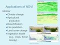 Image Analysis using NDVI to Assess Vegetation Greenness (iGETT-Remote Sensing)
 Calculate NDVI, SAVI, MSAVI, NDWI, MNDWI, NBR and NBR2 Indices using Landsat 8 Bands in ArcMap
 normalized difference vegetation index (NDVI) BY ENVI 4.7
 NDVI | Vegetation/Forest Cover Map in ArcGIS
 NDVI & PRI Measurement Theory, Methods, and Applications
 NDVI in ArcGIS
 How to Calculate NDVI Using Landsat 8 Images and QGIS
 Generate NDVI using SAGA GIS