Image Analysis using NDVI to Assess Vegetation Greenness (iGETT-Remote Sensing)
Комментарии отсутствуют
Информация о видео
Другие видео канала
 NDVI - Normalized Difference Vegetation Index
 Basic tutorial 1: Land Cover Classification of Landsat Images
 3 of the biggest mistakes in mapping farms with drones
 2) Remote Sensing Basics For Vegetation Monitoring
 Phantom 4 Multispectral for Agricultural Analysis
 NASA ARSET: Introduction to Change Detection, Session 1/2
 ALLCOMP - DJI TERRA, Phantom 4 Multispectral NDVI, GNDVI, NDRE, LCI, RGB
 حساب مؤشر التغطية النباتية |Calculate landsta 8 NDVI
 Land use/Land cover Change detection Analysis for a Area over a certain timeline like 1989 to 2020
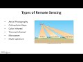 GPS Remote Sensing GIS
 DSLRPros Sentera NDVI Webinar Recap
 Principles of Remote Sensing & Mapping Using Drones
 Spatial and Radiometric Resolution - What is Remote Sensing? (3/9)
 ImageJ Tutorial Area and Threshold
 How to Map High-Value Crops with Drones
 NASA ARSET: Remote Sensing-Based Drought Monitoring, Session 1/2
 Landsat 8 Image Classification with ArcGIS (Supervised)
 Image Analysis 2
 Unsupervised Classification of a satellite image using ArcGIS
 What is NDVI and how can you benefit