NASA ARSET: Remote Sensing-Based Drought Monitoring, Session 1/2
This session includes an overview of drought classification, an introduction to web-based drought monitoring tools, a demonstration of drought data visualization tools, and ends with an exercise for attendees to practice downloading data.
Download materials from this presentation: https://arset.gsfc.nasa.gov/water/webinars/drought17
This training was created by NASA's Applied Remote Sensing Training Program (ARSET). ARSET is a part of NASA's Applied Science's Capacity Building Program. Learn more about ARSET: http://arset.gsfc.nasa.gov/
Видео NASA ARSET: Remote Sensing-Based Drought Monitoring, Session 1/2 канала NASA Video
Показать
Комментарии отсутствуют
Информация о видео
Другие видео канала
 NASA ARSET: Introduction to Change Detection, Session 1/2
 Drought Watch Tutorial
 03 Agriculture Drought Monitoring and Assessment using RS Data
 Imaging and Remote Sensing of Other Worlds - D. Mawet - 4/5/2017
 Voyager Journey to the Stars
 Xiaoxiang Zhu: Artificial intelligence and data science in earth observation
 NASA ARSET: Basics of Synthetic Aperture Radar (SAR), Session 1/4
 PDSI - Palmer Drought Severity Index
 NASA ARSET: Water Budget Estimation using Remote Sensing Observations, Part 2/3
 NASA ARSET: Land Cover Classification with Radar and Optical Data, Part 2/4
 Lucy Barker - Historic Hydrological Droughts
 Voyager 1 & 2 UPDATE-Where Are They?+ Brief Mission Recap (Short Version)
![Intro to Solar Orientation [Solar Schoolhouse]](https://i.ytimg.com/vi/OR8EQ0DWpPw/default.jpg) Intro to Solar Orientation [Solar Schoolhouse]
Intro to Solar Orientation [Solar Schoolhouse] Demonstrating Technologies for Hyperspectral Infrared Remote Sensing from Space on a CubeSat
 Drought monitoring using the Vegetation Condition Index (VCI) In Python, ENVI , R Studio.
 From early warning to early action
 creating DEM with Sentinel-1 in SNAP
 NASA ARSET: SAR for Flood Mapping Using Google Earth Engine, Part 1/3
 NASA ARSET: Drought Monitoring Analysis and Application, Session 2/2
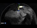 Landsat 8 Swath Animation