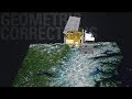
Landsat 8 Swath Animation
The Earth Resources Observation and Science (EROS) Center has created a video animation describing how Landsat 8 orbits the Earth. The video explains the 16-day cycle for capturing imagery of the entire world.
----------
Find this video and thousands more at https://usgs.gov/gallery.
Stay up-to-date on USGS topics and news on Twitter, Instagram, Facebook and more at https://usgs.gov/socialmedia.
DYK? The USGS.gov site is completely mobile! Ditch the desktop and browse the latest earth science on your mobile device. Go to https://usgs.gov.
Видео Landsat 8 Swath Animation канала USGS
Показать
Комментарии отсутствуют
Информация о видео
Другие видео канала
 Every Pixel - Processing Data
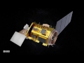 Anatomy of Landsat 8
 Landsat Collections
 Getting Started with MODIS V6 Surface Reflectance Data Part 2
 Lava lake in Halema‘uma‘u remains active
 February 7– 10, 2022 – Kīlauea summit eruption thermal timelapse video
 Lesson 7a - EarthExplorer Introduction
 Coastal Change in Arctic Alaska
 Getting Started with MODIS V6 Surface Reflectance Data Part 3
 February 17, 2022 — Typical activity at the west vent in Halema‘uma‘u, Kīlauea
 Monthly update of activity at Yellowstone Volcano for March 2022
 PubTalk 5/2017 — Underwater Secrets of the Hayward Fault Zone
 Getting Started with MODIS V6 Surface Reflectance Data Part 1
 Image of the Week - Olympic Skiing in Beijing
 Lesson 9b - Accessing USGS Historical Maps through TopoView
 North Pacific Marine Heatwave
 2022 Polar Bear Research Masterplan
 Northeast Wisconsin Airborne Electromagnetic Survey 2021 - Helicopter and survey equipment takeoff
 Seismic vs hydrologic triggering of landslide dams in the Oregon Coast Range