Landsat Collections
Landsat Collections: Providing a Stable Environmental Record for Time Series Analysis —
This video introduces the new U.S. Geological Survey (USGS) Landsat Collection 1 inventory structure. Collection 1 required the reprocessing of all archived Landsat data to achieve radiometric and geometric consistency of Level-1 products through time and across all Landsat sensors. This video explains why Collection 1 is the highest quality inventory of Landsat Level-1 products ever created. To learn more about Landsat Collections please visit https://usgs.gov/landsat-collections.
The Landsat Program is a series of Earth-observing satellites co-managed by USGS and NASA, and offers the longest continuous space-based record of Earth’s land in existence. Every day, Landsat satellites orbit Earth and provide essential information to help land managers and policymakers make informed decisions about our natural resources and environment. All Landsat data are distributed by the USGS at no charge from EarthExplorer, GloVis NEXT and the LandsatLook Viewer. To learn more about the Landsat Program please visit https://usgs.gov/landsat or follow us on Twitter @USGSLandsat or Facebook @NASA.Landsat.
----------
Find this video and thousands more at https://usgs.gov/gallery.
Stay up-to-date on USGS topics and news on Twitter, Instagram, Facebook and more at https://usgs.gov/socialmedia.
DYK? The USGS.gov site is completely mobile! Ditch the desktop and browse the latest earth science on your mobile device. Go to https://usgs.gov.
Видео Landsat Collections канала USGS
Показать
Комментарии отсутствуют
Информация о видео
Другие видео канала
 Landsat 8: 5-Year Anniversary
 Forecast Mekong: Virtual River of Life
 Landsat Collections - RMSE
 February 14, 2023 — Continued lava lake activity at Kīlauea summit
 Living with Fire: Fire Decision Model
 I Am A...Wildlife Biologist
 Lake Powell Water Quality Samples at a Specific Depth
 Landsat in Action - Changing Forest Phenology with Andrew Elmore
 USGS Emergency Management 101 Onsite leadership and communication
 Vent that formed on the wall of Halema‘uma‘u crater, Kīlauea volcano — June 7, 2023
 Climate Science Champions, Season 1: Vanessa von Biela, Research Fish Biologist
 June 18, 2023 — Video of southwest wall vent in Halemaʻumaʻu
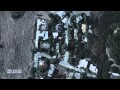 Living with Fire: Human Fire Ignitions
 NMIC - 2017 Mineral Commodity Summaries Release
 Lava fountaining in Halema'uma'u crater—October 12, 2021
 Collecting water data for the U.S.
 Churn Operation
 2011: The Year of the Flood
 Hatching an Engineer
 Advances in Streamgaging | Reach-Scale Monitoring Experiment (2 of 2)
 GEO XIV Plenary 2017