Delineating Multiple Watersheds using Spatial Analyst Tool of ArcGIS
The video tutorial shows you how to delineate not only one, but multiple watersheds based on specified outlet points (pour points).
Detailed step-by-step guide on delineating a watershed - https://www.youtube.com/watch?v=v3Ajg6W8Rj8&t=18s
⭐NOTE:
‘Kite’ is an excellent tool that can help you boost your productivity when it comes to programming with its free Artificial Intelligence (AI) powered coding assistant. Kite is a plugin which provides smart completions and documentation as you’re typing-in your code, and its compatible with most of the well-known IDEs such as PyCharm, Spyder and VS Code. I absolutely love it, and recommend you guys to try it out as well.
https://www.kite.com/get-kite/?utm_medium=referral&utm_source=youtube&utm_campaign=geodelta&utm_content=description-only
Видео Delineating Multiple Watersheds using Spatial Analyst Tool of ArcGIS канала GeoDelta Labs
Показать
Комментарии отсутствуют
Информация о видео
Другие видео канала
 Automatic Extraction of Watershed using DEM data
 Detail Watershed Delineation using DEM in #ArcGIS
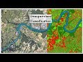 Unsupervised Classification of a satellite image using ArcGIS
 Deriving River Network & Catchments from a DEM using QGIS
 How to extract contour lines And DEM from Google Earth
 Delineating Watersheds in ArcGIS Pro
 Create Thiessen Polygons using ArcMap and Calculating Thiessen Weights
 Calculating the Volume of a Raster using 3D Analyst of ArcGIS (ArcMap + ArcScene)
 Stream Order from a Digital Elevation Model (DEM) using ArcGIS
 4. Delineate watershed by Pour Point in ArcGis
 Watershed Delineation in GIS Very Easy Method
 Manual Watershed Delineation - QGIS
 How to Download ASTER DEM 30m Data for FREE
 How to delineate basin/sub-basin/watershed by using DEM in Arcmap ??
 How to delineate a watershed in Google Earth?
 Google Earth Pro - A Complete Beginner’s Guide
 Watershed Delination
 Creating a Heatmap using QGIS
 Catchment area Calculation using arcgis 10.4 : watershed delineation