Cassie Autonomously Navigates in Four Long Corridors (200 meters)
Cassie Blue autonomously navigates on the second floor of the Ford Robotics Building at the University of Michigan. The total traverse distance is 200 m (656.168 feet).
The LiDAR and IMU data are fused in real-time to form an elevation map. The system consists of a low-frequency planning thread (5 Hz) to find an asymptotically optimal path and a high-frequency reactive thread (300 Hz) to accommodate robot deviation. The planning thread includes: a multi-layer local map to compute traversability for the robot on the terrain; an anytime omnidirectional Control Lyapunov Function (CLF) for use with a Rapidly Exploring Random Tree Star (RRT*) that generates a vector field for specifying motion between nodes; a sub-goal finder when the final goal is outside of the current map; and a finite-state machine to handle high-level mission decisions. The paper [https://arxiv.org/abs/2108.06699] provides full details on the reactive planning system.
The software for the planning package is public: [https://github.com/UMich-BipedLab/CLF_reactive_planning_system]
Видео Cassie Autonomously Navigates in Four Long Corridors (200 meters) канала Michigan Robotics: Dynamic Legged Locomotion Lab
Показать
Комментарии отсутствуют
Информация о видео
30 ноября 2021 г. 2:08:14
00:04:17
Другие видео канала
 Wandercraft at Viva Technology 24 May 2018
 Cassie Blue's POV when visting the First Robotics World Championships in Detroit on April 26, 2018
 Cassie vs The Hill
![MARLO vs Wave Field: Round 2 (Blindfolded) [Long Version]](https://i.ytimg.com/vi/1NkZEuxU1i8/default.jpg) MARLO vs Wave Field: Round 2 (Blindfolded) [Long Version]
MARLO vs Wave Field: Round 2 (Blindfolded) [Long Version] Cassie on a 1.2 m/s Moving Walkway
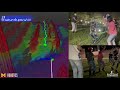 Fully Autonomy on the Wave Field 2021
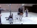 Walking and U Turn Near EECS Building
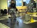 Bipedal Robot Rabbit: Falling when controller is turned off (Grenoble, March 2003)
 Nonholonomic Virtual Constraints and Gait Optimization for Robust Walking Control
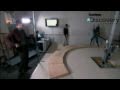 Tales of the Encoder
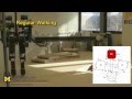 Bipedal Robot MABEL Traverses Uneven Terrain Using Touch Instead of Sight
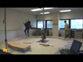 8 inch (20 cm) Blind Step-down Experiment on Bipedal Robot MABEL
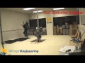 Control Lyapunov Function (CLF-based) Feedback Controller on MABEL
 Terrain-Adaptive, ALIP-Based Bipedal Locomotion Controller via MPC and Virtual Constraints-Short
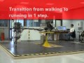 Bipedal Robot Rabbit: Six running steps (Grenoble, September 2004)
 MABEL Walking - Virtual Constraints designed by hand
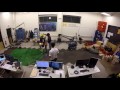 Second Practice Session For MARLO vs the Wave Field
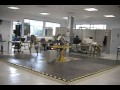 Bipedal Robot Rabbit: Extended Perturbation (Grenoble 3 Sept 2004)
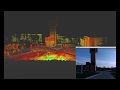 Scenes of the UM Campus seen through the eyes of a bipedal robot: InEKF LiDAR mapping on Cassie Blue
 Walking Gait Optimization for Accommodation of Unknown Terrain Height Variations