The Volcano in Washington with 1,500 Foot High Lava Flows; Spiral Butte
In Washington State is a spiral shaped lava flow which in sections is more than 1,500 feet in height. Known as Spiral Butte, this thick dacite lava flow likely represents the youngest eruptive products of a potentially dormant volcano. Spiral Butte is located southeast of Mount Rainier and does not represent an isolated vent.
Thumbnail Photo Credit: Google Earth, Image U.S. Geological Survey. Image was then overlaid with text, the GeologyHub logo, & an orange border overlay.
If you would like to support this channel, consider becoming a patron at http://patreon.com/geologyhub.
Become a channel member to get access to perks:
https://www.youtube.com/channel/UCYeGh5VML5XPr5jYnzh3J6g/join
Another way to support this channel is to make an order via our gemstone and geology related etsy store at http://prospectingarizona.etsy.com.
This channel's merch store is also on etsy at http://geologyhub.etsy.com.
Source of Volcanic Explosivity Index (VEI) methodology and criteria: Newhall, C. G., and Self, S. (1982), The volcanic explosivity index (VEI) an estimate of explosive magnitude for historical volcanism, J. Geophys. Res., 87(C2), 1231–1238, doi:10.1029/JC087iC02p01231. Accessed / Read by Youtube.com/GeologyHub on Oct 5th, 2022.
Google Earth imagery used in this video: ©Google & Data Providers
This video is protected under “fair use”. If you see an image and/or video which is your own in this video, and/or think my discussion of a scientific paper (and/or discussion/mentioning of the data/information within a scientific paper) does not fall under the fair use doctrine, and wish for it to be censored or removed, contact me by email at geologyhubyt@gmail.com and I will make the necessary changes.
A list of Creative Commons licenses and other licenses (such as content being marked as "public domain" by a specific government as an example) used for specific content (such as image/images, video/videos, sound/sounds, data/information, or a smaller image or images within a larger diagram or diagrams within the video where the video as a whole does not entirely fall under the same license (content falling under one or more of these licenses is typically labeled on screen in the lower right corner (and occasionally in the lower left corner) or in the video's description with a timestamp)) in this video (and/or in this video's thumbnail image):
Public Domain: https://creativecommons.org/publicdomain/mark/1.0/
Do note that content which falls under one of these license(s) mentioned above in this video will be marked as such via attribution displayed on screen at the time said content in the video appears.
Sources/Citations:
[1] U.S. Geological Survey
[2] Michael A. Korosec, Open File Report 84-2, January 1984, Summary of Geothermal Exploration Activity In the State of Washington from 1978 to 1983, Prepared under U.S. Department of Energy Contract No. DE-AC07-79ET27014 for Assessment of Geothermal Resources in Washington
[3] Benjamin W. Stanton and Joe D. Dragovich, Washington Department of Natural Resouces, Division of Geology and Earth Resources, Mapping of Major Latest Pleistocene to Holocene Eruptive Episodes From the Glacier Peak Volcano, Washington—A Record of Laharic Inundation of the Puget Lowlands From Darrington to Puget Sound
[4] VEIs for volcanic eruptions rated VEI 0, 1, 2, & 3 are based on the estimates of YouTube.com/GeologyHub. Dates from volcanic eruptions (and their VEIs) which were assigned a VEI 4 or larger are sourced from the LaMEVE database (British Geological Survey © UKRI)
0:00 Volcanoes in Washington
0:58 Age Estimate
2:13 Spiral Butte Eruption
3:21 Eruption Size
3:45 Conclusion
Видео The Volcano in Washington with 1,500 Foot High Lava Flows; Spiral Butte канала GeologyHub
Показать
Комментарии отсутствуют
Информация о видео
Другие видео канала
 The Active Mount Cameroon Volcano; One of the World's Largest Volcanoes
 Aragonite, the Mineral which Looks like a Naval Mine
 The Geologic Oddity in Australia; The 12 Apostles
 This Week in Volcano News; A Large Hole Appears in the Askja Volcano
 This Week in Volcano News; Mauna Loa and Mount Etna Produce New Eruptions
 This Week in Volcano News; Kilauea Erupts in Hawaii, A Volcano in India Erupts
 This Week in Volcano News; Alert Level Changes in Hawaii & Alaska, Ecuador Earthquakes
 This Week in Volcano News; Increased Temperatures at the Cerro Machin Volcano
 2 New Volcanic Eruptions in Japan; Nishinoshima & Bayonnaise Rocks
 The Geologic Oddity in Turkey; Towering Fairy Chimneys
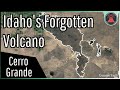 Idaho's Forgotten Volcano; The Cerro Grande Lava Field
 This Week in Volcano News; Activity at 4 Alaskan Volcanoes, San Cristobal Erupts
 The Active Volcano in Idaho; Hell's Half Acre
 10,000 Years of Lava; A Timelapse of Kilauea's Eruptions
 This Week in Volcano News; Canary Islands Earthquakes, Karangetang Erupts
 The Towering Glaciers of Salt Which Move Every Year; The Zagros Glaciers
 The Active Volcano in Norway; Bouvet Island
 The Active Volcano in Alaska; Snowy Mountain
 Ruang Volcano Eruption Update; A Geologist Answers Your Questions
 Kilauea's Highly Explosive Eruptions; Why They Occur