Layer Stacking of Satellite Images (Sentinel and Landsat) in QGIS
This Video explains on how to stack Sentinel or Landsat images in QGIS, How to see band combination, and Sentinel image spatial resolution and pan sharpening lecture.
Видео Layer Stacking of Satellite Images (Sentinel and Landsat) in QGIS канала GIS Training
Видео Layer Stacking of Satellite Images (Sentinel and Landsat) in QGIS канала GIS Training
Показать
Комментарии отсутствуют
Информация о видео
Другие видео канала
 Calculate NDVI from Sentinel 2 and reclassify in QGIS
 Pan Sharpening in QGIS
 Land Cover Classification using the Semi-Automatic Classification Plugin version 7
 Tutorial: Land Cover Classification and Mosaic of Several Landsat images
 QGIS Terrain Analysis: hillshade, slope, aspect (Version 3.x)
 CALCULO DE INDICES DE VEGETACIÓN A PARTIR DE IMÁGENES SATELITALES SENTINEL 2 SAVI NDVI NDMI
 Calculating vegetation indices & plant/soil separation with QGIS (Drones in agriculture series, 3/7)
 NDVI with class range in ArcGIS
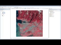 Satellite images in ArcMap - An Introduction
 ESA Echoes in Space - Land: Crop type mapping with Sentinel-1
 Flood Monitoring Tutorial with Sentinel 2 and Landsat 8 Images in QGIS 3
 Georeferencing a Satellite Image Using Another Georeferenced Image in ERDAS Imagine
 Layer stacking Sentinel 2 (or Landsat 8) imagery using QGIS 3
 QGIS Tutorial- Layer Stack of Satellite Image || Layer Stack in QGIS
 How to Clip / Subset Raster in ArcGIS
 Object-based Image classification in QGIS || OBIA !! || A complete Tutorial
 v8 Clip and composite Landsat bands in ArcMap
 Pre-processing Of Sentinel-2 Images in QGIS
 QGIS 4 Arch - Satellite Remote Sensing with Sentinel-2 (SCP, NDVI, Band Combos, Raster Calculator)
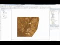 Landsat 8: Atmospheric Correction and Band Rationing Using ArcGIS