Cropland Suitability Analysis using Weighted Overlay in Arc GIS (with Demo Data)
Hello Everybody, in this video we are going to Learn to do suitability analysis using Weighted Overlay Analysis in Arc GIS.
The download link for data is --
Map package : https://archive.org/download/site-suitabiliy-for-crop-land-lamahi/site-suitabiliy-for-crop-land-lamahi_archive.torrent
Weightage for MCDA for Cropland Suitability in ArcGIS : https://archive.org/download/weightage/weightage.pdf
If you have any queries, then fee free to comment on the comment box.
See this also
👉 Extracting DEM from Stereo Pair Images using the ENVI 5.3 https://youtu.be/WCYJ-m6imfw
👉 Full ArcGIS Training https://youtu.be/uRoPk8h1gY0
👉 ArcGIS Training | Tools and Menus| Basic Operations | Thematic Map and Map Layout | NDVI | Watershed https://youtu.be/g3yo3Luywv0
👉 Paragliding Monitoring System https://www.youtube.com/watch?v=SSrv-...
👉 Babai Dang Flood Simulation in Arc Scene https://www.youtube.com/watch?v=QSahA...
👉 Paddy Mass Index Calculation https://www.youtube.com/watch?v=6YkrZ...
👉 Download data from Topcon ES 105 Total Station using USB https://www.youtube.com/watch?v=5veUe...
👉 Model Builder in ArcGIS https://www.youtube.com/watch?v=nPdL6...
👉 Aerial View of Pashchimanchal Campus https://www.youtube.com/watch?v=k8LUT...
👉 3D Map Modelling https://www.youtube.com/watch?v=ntmIN...
👉 Introduction to Google Earth Engine : https://www.youtube.com/watch?v=7Bgw8...
👉 Downloading Data from Open Street Map using QGIS https://youtu.be/MwlGzjT20A8
If you want any sort of GIS and Remote Sensing Services, Surveying, 3D Modelling, Web GIS and any sort of services and training related to Geomatics Engineering, contact :
Dinesh Bishwakarma
9844995572 , 9818357563
mylife.dinesh08@gmail.com
www.dineshbishwakarma.com.np
Видео Cropland Suitability Analysis using Weighted Overlay in Arc GIS (with Demo Data) канала Dinesh Bishwakarma
Показать
Комментарии отсутствуют
Информация о видео
Другие видео канала
 NDVI Map from Sentinel 2A Imageries in Google Earth Engine
 Basic Suitability analysis Qgis Task01
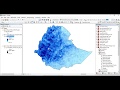 How to Download TRMM Precipitation Data and Estimate Erosivity Factor in ArcMap
 Site Suitability Analysis with ArcGIS
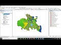 Supervised Image Classification | Land Use & Land Cover Map in ArcGIS
 Groundwater Potential zone Mapping in Arc GIS using Analytic Hierarchy Process (AHP) - Part 1
 How to make a study area on ARC GIS in Amharic በ ARCGIS ላይ የጥናት ቦታ እንዴት እንደሚሰራ
![[QGIS APPLICATION] Multiple Criteria Decision Making For Selection of Suitable Agricultural Land](https://i.ytimg.com/vi/TDwg8Wi5rYs/default.jpg) [QGIS APPLICATION] Multiple Criteria Decision Making For Selection of Suitable Agricultural Land
[QGIS APPLICATION] Multiple Criteria Decision Making For Selection of Suitable Agricultural Land Flood Risk Simulation Map of an area using ArcGIS
 Making GIS Map using Google Earth Pro and QGIS
 Creating spectral indices NDVI NDBI NDWI NDMI | ArcGIS Tutorial
 Suitability Analysis Using Arcgis : Complete Project
 CROPLAND SUITABILITY ZONE (AHP) METHOD IN WEIGHTED OVERLAY BY ARC GIS 10.3
 Suitable Site Selection for Urban Solid waste disposal : part 3-5 GIS
 Cut polygon with a line, in QGIS
 Calculating the Criteria Weight by Multiple Criteria Decision Making || AHP Method ||@GeoTech Studio
 Slope, Aspect, Contour , Hillshade Map in ArcGIS
 LULC Prediction Tutorial Part 1: Land Use/Land Cover Map
 Landsat 8 Image Classification with ArcGIS (Supervised)
 Showing DEM in 3D View in ArcGIS || DEM in 3D View in ArcMap || DEM in Arcsene