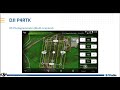
DJI Phantom 4 RTK - TBC Processing with Ground Control Points
This video explains how to import raw data from the field and pick GCPs to adjust the images from the DJI Phantom 4 RTK in Trimble Business Center. The GCP adjustment can be done with or without a GNSS trajectory from the DJI Phantom 4 RTK unit.
Available as shown in TBC v5.40 and later.
Need demo datasets? Visit https://geospatial.trimble.com/trimble-business-center-tutorials.
For questions, contact your local Trimble representatives and distributors. Find them here: https://geospatial.trimble.com/where-to-buy
Geospatial: https://geospatial.trimble.com/products-and-solutions/trimble-business-center
Construction: https://construction.trimble.com/products-and-solutions/trimble-business-center
Видео DJI Phantom 4 RTK - TBC Processing with Ground Control Points канала TBC Survey and Construction
Показать
Комментарии отсутствуют
Информация о видео
17 декабря 2020 г. 4:18:50
00:17:05
Другие видео канала
 DJI + Trimble Better Together - Base stations, Phantom 4 RTK, + More
 Trimble Business Center: Create CAD Points & Coordinates from Scan Points
 Overhead Lines and Curb + Gutter Linear Feature Extraction
 DJI Phantom 4 & Phantom 4 Pro Tutorial Overview
 Processing Drone Images with GCPs using Pix4D Mapper
 Placing Ground Control Points
 PHANTOM 4 RTK | Everything You Should Know | FULL REVIEW AND TEST
 Demo - Xử lý dữ liệu DJI Phantom 4RTK bằng TBC
 Build 4x4 project part 10: Connecting engine and gearbox
 DJI Phantom 4 RTK Drone Mapping
 Trimble Business Center - Basics for SITECH
 What is LiDAR Drone Surveying | Accuracies and Results
 Processing ReCap Photo Aerial Imagery using Ground Control Points
 New Workflow for Phantom 4 RTK Base Station
 DJI Phantom 4 RTK - TBC Baseline Processing with T02
 TBC v5.0 - Semi-Automatic Point Feature Extraction (In-Depth Demonstration)
 DJI Phantom 4 RTK - TBC Baseline Processing with Internet Download
 DJI Phantom 4 | TBC Processing with Ground Control Points
 TBC Feature Library Integration
 Ground Control And Check Shots in Pix4D