DJI + Trimble Better Together - Base stations, Phantom 4 RTK, + More
Webinar December 2020 "DJI + Trimble Better Together - Base stations, Phantom 4 RTK, + More".
DJI, a global leader in unmanned aerial vehicles (UAVs) for survey applications, and Trimble, a global leader in survey and mapping solutions, have partnered to offer our customer bases seamless aerial surveying workflows. Join this webinar as we highlight how to use Trimble GNSS hardware for corrections to DJI flight missions and Trimble Business Center to process, deliver, and integrate survey-grade point clouds and orthomosaics from the DJI Phantom 4 RTK UAV.
Attendees will learn how to:
- Setup and connect their Trimble GNSS base receivers to use as local correction sources for their DJI flights
- Utilize the DJI Phantom 4 RTK UAV in field for their aerial survey projects
- Import and process DJI Phantom 4 RTK UAV data directly into Trimble Business Center v5.40
- Create and integrate deliverables from DJI Phantom 4 RTK UAV with their survey data in Trimble Business Center
Видео DJI + Trimble Better Together - Base stations, Phantom 4 RTK, + More канала Michael Karavanov
Показать
Комментарии отсутствуют
Информация о видео
Другие видео канала
 DJI Agriculture Phantom 4 RTK Mapping tutorial
 Post-Processing GNSS Data with Trimble Business Center 3.00
 Best Practices for RTK & PPK Drone Flights | Webinar Recording
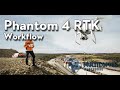 DJI Phantom 4 RTK Workflow Webinar
 Introduction to Trimble Catalyst
 Drone Data Processing for Surveyors
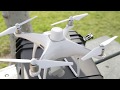 DJI Phantom 4 RTK | Mission Planning & Setup with the D-RTK 2 Base Station
 Session II - Processing Trimble X7 data in TBC project (April 2021)
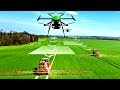 The Future of Farming
 DJI Mavic 2 Enterprise Advanced Unboxing, Setup, and Full Flight!
 DJI Zenmuse L1 & P1 - WORKFLOW WEBINAR
 DJI Phantom 4 RTK Drone Mapping
 Trimble Geospatial Webinar Baseline Processing Workflows
 Trimble X7 and Trimble Perspective - version 2
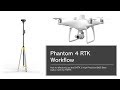 New Workflow for Phantom 4 RTK Base Station
 TBC and UAS Master
 Should I buy a drone with Commercial GPS RTK?
 Combining Multiple Source Datasets in TBC
 DJI Phantom 4 RTK - TBC Processing with Ground Control Points
 DJI Mini 2 Compared to DJI Phantom 4 RTK