Ice breakup on the Skunk River at Augusta, IA
More information on the USGS Multimedia Gallery: http://gallery.usgs.gov/videos/353
This video captures the breakup of ice cover on the Skunk River at Augusta, Iowa, on February 17, 2011, at approximately 3:00 pm CST. The river stage at the time was 14.50 feet (elevation 535.74 feet NGVD29). A preliminary estimate of the discharge at the time of the ice breakup is 9,500 cubic feet per second.
The USGS has operated a streamgage on the Skunk River at Augusta since 1913. The streamgage is located on the left bank of the river, just upstream of the County Highway X38 bridge in Augusta, and 10.4 miles upstream from where the Skunk River flows into the Mississippi River. The Skunk River watershed, encompassing 4,355 square miles, stretches from its headwaters in central Iowa near Williams to the southeastern corner of Iowa south of Burlington. In addition to real-time stage and flow, the USGS also collects a daily record of suspended sediment concentration and routine water-quality samples at the streamgage.
Видео Ice breakup on the Skunk River at Augusta, IA канала USGS
Показать
Комментарии отсутствуют
Информация о видео
Другие видео канала
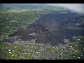 Kīlauea lower East Rift Zone 2019: quiet but insightful
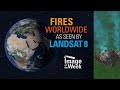 Image of the Week - Fires Worldwide as Seen by Landsat 8
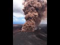 Largest Gravity Changes Ever Recorded: 2018 Kīlauea Eruption
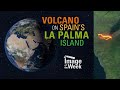 Image of the Week - Volcano on Spain's La Palma Island
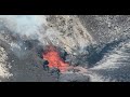 Lava fountains from western fissure, Halema‘uma‘u, Kīlauea - October 5, 2021
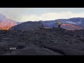 Kīlauea Volcano — Lava Scenes From Fissure 8
 Lees Ferry - 100 Years of Streamflow Monitoring
 PubTalk - 9/2021: Modernizing the National Water Information System
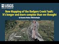 PubTalk 5/2019 - Rodgers Creek Fault
 Monthly update of activity at Yellowstone Volcano for October 2021
 Earth Observation User Case Study: Power of the Pixel from 1972 to 2021
 Kīlauea summit eruption in Halemaʻumaʻu crater - western fountain - October 2, 2021
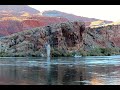 B-Roll of Lees Ferry
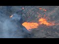 Kīlauea summit eruption in Halemaʻumaʻu crater - low central fountain - October 2, 2021
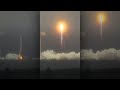 Landsat 9 Launch from Vandenberg: 3 Views
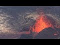 Kīlauea summit eruption in Halemaʻumaʻu crater - west vent - October 4, 2021
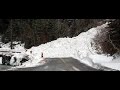 Snow avalanches: A hazard and driver of landscape change
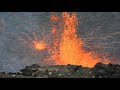 Kīlauea summit eruption in Halemaʻumaʻu crater - southern crater rim - October 2, 2021
 A Legacy Continues with Landsat 9 Launch
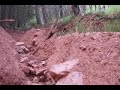 Water and sediment supply requirements for post-wildfire debris flows in the western United States