Monthly update of activity at Yellowstone Volcano for October 2021
Yellowstone’s semi-permanent GPS sensors head home for the winter.
Mike Poland, the Scientist-in-Charge of the Yellowstone Volcano Observatory, provides the October update from the warehouse at the Cascades Volcano Observatory, where the YVO field team is getting ready to head out to Yellowstone to pick up instruments that have been collecting data on ground surface changes all summer.
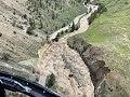
Yellowstone volcano is monitored by dozens of GPS stations that continuously radio information to the observatory in real-time, 24/7, 365 days a year. The deformation network also includes semi-permanent GPS that are installed every May and collected in October. These instruments are not connected by a radio link, so data has to be downloaded when the instruments are back at the observatory. The primary purpose of the semi-permanent GPS network is to add to the data collected by the continuous network, to gain a broad picture of changes that happen from year to year.
The semi-permanent GPS is also good at collecting data on subtle changes in different areas. A good example of this is the deformation caused by Yellowstone Lake. Every spring, when the snow starts to melt, the level of Yellowstone Lake rises as it fills with water. During the summer, the lake level goes down as water drains into the outlet channel.
As the water rises in the springtime, more weight is put on the ground, and the ground around the lake subsides. As the water drains out of the lake, the ground rises because some of that water weight is removed. The weight of water causes ground deformation that can be detected by the semi-permanent GPS network deployed along the shore.
The video shows the components of a semi-permanent GPS station, and includes a recap of seismic activity and ground deformation at Yellowstone volcano for the past month, along with what’s going on at Steamboat Geyser.
Video:https://www.usgs.gov/media/videos/monthly-update-activity-yellowstone-volcano-october-2021
Видео Monthly update of activity at Yellowstone Volcano for October 2021 канала USGS
Mike Poland, the Scientist-in-Charge of the Yellowstone Volcano Observatory, provides the October update from the warehouse at the Cascades Volcano Observatory, where the YVO field team is getting ready to head out to Yellowstone to pick up instruments that have been collecting data on ground surface changes all summer.
Yellowstone volcano is monitored by dozens of GPS stations that continuously radio information to the observatory in real-time, 24/7, 365 days a year. The deformation network also includes semi-permanent GPS that are installed every May and collected in October. These instruments are not connected by a radio link, so data has to be downloaded when the instruments are back at the observatory. The primary purpose of the semi-permanent GPS network is to add to the data collected by the continuous network, to gain a broad picture of changes that happen from year to year.
The semi-permanent GPS is also good at collecting data on subtle changes in different areas. A good example of this is the deformation caused by Yellowstone Lake. Every spring, when the snow starts to melt, the level of Yellowstone Lake rises as it fills with water. During the summer, the lake level goes down as water drains into the outlet channel.
As the water rises in the springtime, more weight is put on the ground, and the ground around the lake subsides. As the water drains out of the lake, the ground rises because some of that water weight is removed. The weight of water causes ground deformation that can be detected by the semi-permanent GPS network deployed along the shore.
The video shows the components of a semi-permanent GPS station, and includes a recap of seismic activity and ground deformation at Yellowstone volcano for the past month, along with what’s going on at Steamboat Geyser.
Video:https://www.usgs.gov/media/videos/monthly-update-activity-yellowstone-volcano-october-2021
Видео Monthly update of activity at Yellowstone Volcano for October 2021 канала USGS
Показать
Комментарии отсутствуют
Информация о видео
Другие видео канала
 Monthly update of activity at Yellowstone Volcano for July 2022
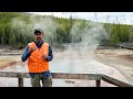 Monthly update of activity at Yellowstone Volcano for June 2021
 June 15 — Small collapse into lava lake at Kīlauea summit
 Monthly update of activity at Yellowstone Volcano for August 1, 2022 from Mammoth Hot Springs
 Timelapse showing rise of Halema‘uma‘u crater floor
 USGS ground failure product: Near-real-time estimates of quake-triggered landslides, liquefaction
 Utah’s ancient mega-landslides.
 Gulf of Mexico Groundwater Wells
 MassWastingRouter: A watershed-scale sediment production (landslides!) and transport model
 PubTalk-06/2022 - Keeping Tabs on the Volcanoes of the Last Frontier
 NextGen Water Data Update: Monitoring Location Pages & WaterAlert
 Reducción de los riesgos de inundación mediante la restauración de los arrecifes de coral (con AD)
 Shear surface undulations modulate gouge strength and contribute to divergent landslide acceleration
 PubTalk-07/2022 - Mapping the World from Satellites
 Five decades of progress in landslide assessments
 PubTalk-03/2022 - Hoofing it in the West: Conservation Challenges & Solutions for Migratory Big Game
 Landsat: Celebrating 50 Years (Extended Edition)
 USGS Patent: Handheld Underwater Suction Sample
 Bon Voyage, Rafael
 Reducción de los riesgos de inundación mediante la restauración de los arrecifes de coral