B-Roll of Lees Ferry
Here is a collection of video for use in products related to the USGS's streamgage at Lees Ferry. The USGS installed the Lees Ferry gauge 100 years ago, and the data collected since have become critical to monitoring water availability in the West.
Video: https://www.usgs.gov/media/videos/b-roll-lees-ferry
----
0:00 Title slide
0:25 Lees Ferry streamgage wide shot and pan
0:33 Lees Ferry streamgage kayak and boat
0:42 Lees Ferry streamgage closeup front
0:51 Lees Ferry streamgage closeup back
1:02 Lees Ferry streamgage side
1:14 Lees Ferry streamgage front from across river
1:35 Geographer Geoff DeBenedetto holding benchmark
1:47 water quality measurement boat and cableway zoom
2:02 wide water quality boat cableway zoom
2:58 wide water quality boat cableway cliffs zoom
3:56 wide water quality boat cableway cliffs zoom
5:25 Medium water quality boat cableway
5:36 Technician on cableway streamgage zoom out boat
6:11 Technician moving along cableway boat ramp
6:51 Closeup of water quality measurement
7:59 Drone confluence of Paria and Colorado River downstream
8:15 Drone Lees Ferry boat ramp upstream from streamgage
Видео B-Roll of Lees Ferry канала USGS
Показать
Комментарии отсутствуют
Информация о видео
Другие видео канала
 Lake Mead: Clear and Vital
 Yellowstone Volcano Update for August 2021
 Water appears in Halemaʻumaʻu - Kīlauea Volcano
 The story of Yellowstone's ups and downs
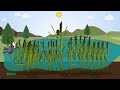 Importance of Cattails in Wetlands
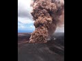
 Kīlauea summit overflight video – May 10, 2022
 Monthly update of activity at Yellowstone Volcano for July 2021
 Rise of the Halema‘uma‘u crater floor
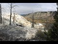 YVO monthly update of activity at Yellowstone Volcano for June 2022
 Largest Gravity Changes Ever Recorded: 2018 Kīlauea Eruption
 Washington Geological Survey’s Landslide Hazard Program
 Mount St. Helens: May 18, 1980
 May 26, 2022 — Kīlauea — Lava lake activity continues at the summit
 Kīlauea Volcano, Halemaʻumaʻu Crater, Summit Vent Lava Lake (4K B-Roll)
 USGS End of Year Accomplishments 2020
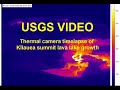 June 13, 2022 — Thermal camera timelapse of Kīlauea summit lava lake growth
 Re-greening a Dryland Watershed
 Coastal Wetlands
 Yellowstone Volcano Observatory Monthly Update for January 2021