Calculating the volume of Lake-Pond-Reservoir/ Raster using 3D Analyst in Arc-GIS(Arc-map+arc scene)
To estimate the storage capacity of water bodies like lakes, ponds, and reservoirs, can be performed through indirect methods, which calculate the volume of water retained through cartographic information, bathymetry and a digital elevation model are required for the calculation is performed with the tools of ArcGIS 3D Analyst extension.
The volume represents the region between the surface and space above or below the polygon features based on the selection made in the Reference Plane parameter:
Calculate above the plane—Volume is calculated between the plane and the underside of the surface.
Calculate below the plane—Volume is calculated between the plane and the topside of the surface. The surface area for the same portion of the surface is also calculated.
Видео Calculating the volume of Lake-Pond-Reservoir/ Raster using 3D Analyst in Arc-GIS(Arc-map+arc scene) канала Technical Esro Arc-GIS Master
Показать
Комментарии отсутствуют
Информация о видео
9 апреля 2020 г. 16:28:01
00:10:31
Другие видео канала
 How to calculate the volume of reservoir of Dam using ArcGIS
 Calculate the volume of lake in ArcGis
 Converting Points to A Polygon Using ArcMap Tools
 Why Are 96,000,000 Black Balls on This Reservoir?
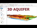 Three-Dimensional Visualization of Ground-water Model ArcGIS & ArcScene/Development of 3D Aquifer
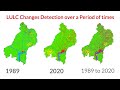 Land use/Land cover Change detection Analysis for an Area over a certain timeline like 1989 to 2020
 v41 computing volume from a DEM in ArcMap
 Intro to Remote Sensing Workflows using ArcGIS
 ESRI ArcGIS 10: 3D GIS at ArcGIS 10
 Extracting Elevation Data from Google Earth
 How to extract coordinates (Easting, Northing, Elevation) of any point |Using Google Earth
 ArcGis 3d analyst Draping an image over a terrain surface
 3D visualization of Data in QGIS
 How to create Digital Elevation Model DEM from Google Earth DATA in ArcGIS
 Calculating the Volume of a Raster using 3D Analyst of ArcGIS (ArcMap + ArcScene)
 Georeferencing in ArcMap Tutorial
 Surface Volume of Raster (2D and 3D Area) using 3D Analyst ArcMap and Visualize using ArcScene
 How to download a Digital Elevation Model (DEM) file from USGS/ Earth Explorer
 Study Area Mapping | Create Map Layout in ArcGIS
 How to digitize automatic a scanned topographic map with ArcGIS