Downloading a Digital Elevation Model (NASA) from NASA EarthData –Tutorial
The terrain properties of a study area are of great importance due to the vast information they provide for water and land management. The elevation values can be obtained by advanced spaceborn techniques such as the use of remote sensing from satellites. On June 29, 2009, NASA and the Ministry of Economy, Trade, and Industry (METI) of Japan released a Global Digital Elevation Model (GDEM) to users worldwide at no charge as a contribution to the Global Earth Observing System of Systems (METI and NASA, 2011). This tutorial is a demonstration of how to download a Digital Elevation Model (DEM) from the ADVANCED SPACEBORNE THERMAL EMISSION AND REFLECTION RADIOMETER (ASTER) Version 2. In addition, how to merge two DEM rasters and how to change the style of them in QGIS 2.15 will be shown.
Видео Downloading a Digital Elevation Model (NASA) from NASA EarthData –Tutorial канала Hatari Labs
Видео Downloading a Digital Elevation Model (NASA) from NASA EarthData –Tutorial канала Hatari Labs
Показать
Комментарии отсутствуют
Информация о видео
Другие видео канала
 How to obtain a Basin and Channel Network from a No-sinks DEM in SAGA GIS and QGIS – Tutorial
 Earthdata Webinar: Explore the Entire Earth, Every Day, with Satellite Imagery from NASA Worldview
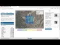 download free DEM 12 to 5 meters (world)
 Earthdata Webinar: TRMM and GPM Precipitation Products and Data Services at the NASA GES DISC
 Download SRTM 30m Digital Elevation Models for Free
 ATLAS MAP 1 | GPlates & Color Schemes
 Getting Started with NASA Global Ecosystems Dynamics Investigation (GEDI) Lidar Data
 An Absolute Beginner's Guide to QGIS 3
 A Complete Beginner's Guide to ArcGIS Desktop (Part 1)
 Digital Elevation Models in GIS (theory) - updated
 Download free DEM Digital Elevation Model 10 meters by Global Mapper
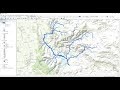 Stream Order from a Digital Elevation Model (DEM) using ArcGIS
 QGIS Download 30m SRTM DEMs
 How to Download ASTER DEM 30m Data for FREE
![Open Data: Download data from EarthData [EN]](https://i.ytimg.com/vi/vJzSYk1Ip6I/default.jpg) Open Data: Download data from EarthData [EN]
Open Data: Download data from EarthData [EN] How to insert Topography Data from a Digital Elevation Model into Model Muse - Tutorial
 NASA ARSET: Groundwater Monitoring using Observations from NASA’s GRACE Missions
 Deriving River Network & Catchments from a DEM using QGIS
 Arcgis : Merge the raster datasets /fusionner raster arcgis /Mosaic raster dataset ArcGIS
 Download Topographic Maps from Google Earth