Automatic LiDAR Reclassification in Global Mapper
In the fourth webcast in the LiDAR Processing series, we show the procedure for improving the usability of LiDAR by flagging noise points and identifying points that represent specific surface types. Foremost in this automatic reclassification process is the detection of ground points in unclassified data, which is a prerequisite for creating a DTM. We also walk through the process of identifying and reclassifying buildings, trees, and power lines based on their geometric properties.
If you have questions about any of the workflows or topics covered in this presentation, email: geohelp@bluemarblegeo.com.
For licensing or sales questions, email orders@bluemarblegeo.com.
To download an evaluation copy of Global Mapper, visit: www.bluemarblegeo.com/products/global-mapper.php
Видео Automatic LiDAR Reclassification in Global Mapper канала Blue Marble Geographics
Показать
Комментарии отсутствуют
Информация о видео
Другие видео канала
 Gridding LiDAR to Create a DTM or DSM in Global Mapper
 Working with Vector Data in Global Mapper
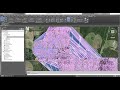 Working with Drone Point Clouds in ReCap and Civil 3D
 GeoTalks Express: What’s New in the Global Mapper Lidar Module v22.1
 Uso de Nubes de Puntos en Civil 3D con el Ing.Luis Carrión
 LiDAR Editing and Filtering in Global Mapper
 TUTORIAL Agisoft Metashape - orthophoto and DSM generation (with GCPs)
 The ABC's of Global Mapper
 Rilievo di facciate tramite fotogrammetria terrestre e software open source
 Using Lidar To Extract 3D Buildings And Trees
 GENERAR CURVAS O COTAS DE NIVEL CON GLOBAL MAPPER
 Feature Extraction from Classified LiDAR Data
 Agisoft Photoscan Professional Tutorial: Creating a DEM without GCPs
 Tips & Tricks: How to Export 3D Path Profile Lines of a Stream in Global Mapper
 Introducing the Pixels-to-Points Tool in Global Mapper
 What's New in the Global Mapper Lidar Module v22
 Automatic extraction and management of semantics within point cloud data
 Como carregar dados de Drone no Global Mapper 21
 Master Plan in Photoshop with Google Earth Pro
 TBC Point Clouds to Civil 3D!