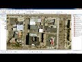
download very hight resolution satellite image tif from SASPLANET
download very hight resolution geoereferenced satellite image from SASPLANET
To see more videos visit website : http://monde-geospatial.com/
Видео download very hight resolution satellite image tif from SASPLANET канала Made 4 Geek
To see more videos visit website : http://monde-geospatial.com/
Видео download very hight resolution satellite image tif from SASPLANET канала Made 4 Geek
Показать
Комментарии отсутствуют
Информация о видео
Другие видео канала
 Download very high resolution satellite image 0.3 metre for free
 Auto georeference aerial photo in ArcGIS | burdGIS
 High Resolution Free Aerial Imagery in SketchUp
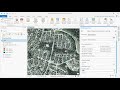 How-to: Extracting Building Footprints using Esri's Deep Learning Model
 ПРАВИЛЬНАЯ НАСТРОЙКА SAS.ПЛАНЕТА v.200606
 Download very hight resolution satellite image into 5m
 Image fusion using Arcgis (Increase resolution 2017)
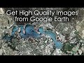 Get High Quality Images from Google Earth Tutorial
 A new high resolution satellite images 2019 by Sas planet
 SAS Planet 2018 to Download corrected satellite images
 Download High Resolution Satellite Image from Bing Maps for free
 Yüksek Çözünürlükte Koordinatlı Uydu Görüntüsü İndirme I SAS Planet
 SAS Planet 2020: Télécharger les images satellitaire avec Haute résolution HD
 Create Offline Tiles using QGIS
 Custom Maps using SAS Planet and Insight Map Creator for B&G, Lowrance, SIMRAD chartplotters
 SAS PLANET: Download very High Resolution Google earth Image for free
 SASPLANET Descargar imágenes de Google Earth, Maps (georeferenciadas) a ArcGIS | MasterSIG
 How to download Shapefile Data GIS for any country
 Download Very High Resolution Google Earth Pro Images Free