Hydrology Tools Map Tutorial – ArcGIS Pro
This video details the workflow to use a DEM to derive a watershed and a stream network using the Hydrology Toolbox. Links to the workflow and the data are below, but you can use any DEM. If you find this video helpful, please like and subscribe. Thanks.
Lab: https://drive.google.com/open?id=1CPOjyRIkrncLm1YBaNyvDir6-yuj7Nc-
Data: https://drive.google.com/open?id=1XHDvX2qTvRK7J4EibKPkMc8mU23_U4ma
Видео Hydrology Tools Map Tutorial – ArcGIS Pro канала MapPractical
Lab: https://drive.google.com/open?id=1CPOjyRIkrncLm1YBaNyvDir6-yuj7Nc-
Data: https://drive.google.com/open?id=1XHDvX2qTvRK7J4EibKPkMc8mU23_U4ma
Видео Hydrology Tools Map Tutorial – ArcGIS Pro канала MapPractical
Показать
Комментарии отсутствуют
Информация о видео
Другие видео канала
 Hydrological modeling in ArcGIS / ArcMap
 DroneCamp2020: Processing UAV Images with ArcGIS Pro
 ArcGIS Pro: Analysis Overview
 Landsat 8 Image Classification with ArcGIS (Supervised)
 Georeferencing an Image in ArcGIS Pro
 ArcMap vs ArcGIS Pro - Comparing these two GIS applications from Esri
 Arc Hydro in ArcGIS Pro
 Stream Order from a Digital Elevation Model (DEM) using ArcGIS
 Delineating Watersheds in ArcGIS Pro
 ArcGIS Enterprise (Portal) & ArcGIS Online
 Basics of ArcPro Coordinate Systems and Projections, Map Tutorial Part 2 – ArcGIS Pro
 Aerial Mapping - DJI - ODM - QGIS
 GIS Apps – Lab 3 – Isarithmic Maps of Paleoclimate Data – ArcGIS Pro
 Watershed Delineation using Hydrology Tool in ArcGIS
 GIS Flood Analysis
 Landsat Change Detection Using ArcGIS
 Manual watershed delineation is a five-step process
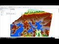 Flood Animation using 3D Analyst tools of ArcGIS (ArcScene + ArcMap)
![How to Create Map in ArcGIS Pro 2.6 - ||Speak Khmer|| - [Khmer GIS Academy]](https://i.ytimg.com/vi/DG2xrJS4adk/default.jpg) How to Create Map in ArcGIS Pro 2.6 - ||Speak Khmer|| - [Khmer GIS Academy]
How to Create Map in ArcGIS Pro 2.6 - ||Speak Khmer|| - [Khmer GIS Academy] 3D Visualization of a DEM in ArcGIS Pro