Image of the Week - Dry Spell Depletes Northern California Reservoirs
A prolonged dry spell has sparked woes over water availability and wildfire in the western United States.
This stretch of northern California is heavily reliant on man-made reservoirs. The recent history of a single Landsat scene can serve to illustrate the ripple effects of those severely parched conditions.
Water levels have dropped in Folsom Lake, Indian Valley Reservoir, Black Butte Lake, where many fields have been left fallow, and Lake Oroville, which is home to the tallest dam in the United States at 770 feet. Each reservoir across this scene's 114 square miles has a wider shoreline today than it did in 2017, the last year with significant precipitation, most of which arrives in the winter and spring each year. Precipitation is more than 8 inches below normal for 2021, a rough start after a 2020 that ended more than 13 inches less than normal.
The 2021 imagery shows evidence of another dry weather worry: large wildfires. The Bear Fire left a charred landscape in the fall of 2020, and scars surround a depleted Lake Berryessa.
Video download: https://www.usgs.gov/media/videos/image-week-dry-spell-depletes-northern-california-reservoirs
Additional Credits: John Hult (Contractor to USGS EROS) - Writer/Voiceover
Видео Image of the Week - Dry Spell Depletes Northern California Reservoirs канала USGS
Показать
Комментарии отсутствуют
Информация о видео
Другие видео канала
 What Does a USGS Hydrologic Technician Do to Inspect Streamgages?
 Effects and Accounts of the 1811-1812 New Madrid Earthquakes
 Hydropower in Ethiopia
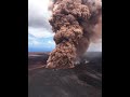 Largest Gravity Changes Ever Recorded: 2018 Kīlauea Eruption
 Mount St. Helens: May 18, 1980
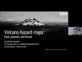 Volcano Hazard Maps: Past, Present, and Future
 Colorado River: Spring Disturbance Flow
 What Does a USGS Hydrologic Technician Do
 Status of (mostly) WA Volcanoes: Report to Emergency Managers 2020-21
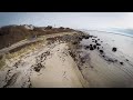 USGS Coastal Change Hazards
 The Yellowstone Volcano Observatory: Overview, Monitoring, Hazards, and Noteworthy Results
 Monthly update of activity at Yellowstone Volcano for June 2021
 What is GEDI?
 PubTalk 5/2017 — Underwater Secrets of the Hayward Fault Zone
 PubTalk 9/2018 - Hayward Earthquake
 A virtual walk through Kīlauea Volcano’s summit history: Part 3
 We are the Coastal and Marine Hazards and Resources Program
 A virtual walk through Kīlauea Volcano’s summit history: Part 2
 Monthly update of activity at Yellowstone Volcano for July 2021
 The Mojave River: A 3D Journey