Open Data: How to download Sentinel imagery from ESA [EN]
[GIS OpenData] In this video I will talk about how to download Sentinel imagery from ESA
==== ESA ====
The European Space Agency (ESA) is Europe’s gateway to space. Its mission is to shape the development of Europe’s space capability and ensure that investment in space continues to deliver benefits to the citizens of Europe and the world.
==== Sentinel-1 ====
The Sentinel-1 mission comprises a constellation of two polar-orbiting satellites, operating day and night performing C-band synthetic aperture radar imaging, enabling them to acquire imagery regardless of the weather.
Sentinel-1 will work in a pre-programmed operation mode to avoid conflicts and to produce a consistent long-term data archive built for applications based on long time series.
Sentinel-1 is the first of the five missions that ESA is developing for the Copernicus initiative.
==== Sentinel-2 ====
The Sentinel-2 User Guide provides a high level description of the MultiSpectral Instrument (MSI), its coverage and acquisition, and available product levels. The User Guide also provides information on the relevant applications of each instrument, the format of the products and the software tools required to interpret the data
==== Sentinel-3 ====
The Sentinel-3 Technical Guide covers an in-depth description of the mission's products and algorithms as well as details on the OLCI, SLSTR, instrument and its performance.
==== QGIS ====
QGIS is a Free and Open Source software for use in Geographic Information System.
It is the best alternative to commercial GIS desktop application such as ESRI ArcGIS (ArcGIS Pro), Hexagon erdas imagine, Geomedia MapInfo due to its user friendly interface. QGIS is the leading open source software, user friendly, cross platform and freely downloadable geographic information system desktop application that is licensed underneath GNU, and it helps viewing, editing, analysing of geospatial data and compliance with open geospatial consortium (OGC) standards.
============================
URL : https://scihub.copernicus.eu
============================
0:18 What data can I get ?
1:03 Sign up
4:37 Download
===========================
GIS4Dev : GIS for beginners
QGIS for beginners, QGIS tutorial, GIS tutorial, GIS web services tutorial, WMS tutorial, WMTS tutorial,
WFS tutorial, WCS tutorial, Google Earth Engine tutorial, ESRI ArcGIS tutorial, Postgresql tutorial, Postgres tutorial,
PostGIS tutorial, GeoServer tutorial for beginners, GeoServer tutorial, OGC, open source software, Google Maps, How to use Google Maps, Google Map tutorial
============================
Contact: pattrawuth2530@gmail.com
Website: http://www.gis4dev.com
Facebook: https://www.facebook.com/GIS4Dev-101058764633058
Twitter: https://twitter.com/pattrawuth4
LinkedIn: https://www.linkedin.com/in/gis4-dev-a87714195
============================
Music Credit: www.bensound.com
============================
#ESA #Sentinel #OpenData #GISOpenData #geo #geospatial #mapping #geography #spatial
Видео Open Data: How to download Sentinel imagery from ESA [EN] канала GIS4DEV
Показать
Комментарии отсутствуют
Информация о видео
Другие видео канала
 QGIS 3 for Absolute Beginners
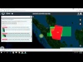 HOW TO DOWNLOAD SENTINEL DATA FROM ESA
![Open Data: Download High Resolution DEM 12.5 m [EN]](https://i.ytimg.com/vi/WvnLFGpvD_I/default.jpg) Open Data: Download High Resolution DEM 12.5 m [EN]
Open Data: Download High Resolution DEM 12.5 m [EN] 2019 - CODE-DE: Suche, Darstellung und Download von Copernicus-Daten über freie Schnittstellen
 QGIS 101: Global Surface Water Data Set - Part 1
 Working with Landsat imagery in ArcGIS Pro
![Open Data: Download data from OpenStreetMap [EN]](https://i.ytimg.com/vi/kCIQrfaDly8/default.jpg) Open Data: Download data from OpenStreetMap [EN]
Open Data: Download data from OpenStreetMap [EN] Sentinel - 2 Uydu Görüntüsü İndirme Copernicus Open Access Hub
 How to download Sentinel-2 imagery in QGIS
![QGIS Tutorial: How to create Elevation Profile in QGIS [EN]](https://i.ytimg.com/vi/acb0-NcUXM8/default.jpg) QGIS Tutorial: How to create Elevation Profile in QGIS [EN]
QGIS Tutorial: How to create Elevation Profile in QGIS [EN] Getting Started with Sentinel-2 Webinar
 How to Create Account in ESA Website for Free (Copernicus open Access Hub)
 Pre-Processing Radar Images (Sentinel-1) in the SNAP software
 NDBI | How to Calculate Normalized Difference Built-up Index in ArcGIS
 How to download Climate Data From CDS Copernicus using Python (cdsapi package)
 How to download Satellite Images from the USGS, ESA and Google Earth Engine
 How to georeference jpeg image map in arcmap part 1
 Extract Globcover Landcover Map From Sentinel-3 SLSTR Level 2 Data Using ESA SNAP and ArcGIS
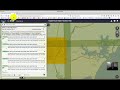 Downloading Sentinel Imagery Via Copernicus Open Access Hub
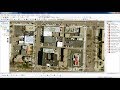 Download very high resolution satellite image 0.3 metre for free