HOW TO DOWNLOAD SENTINEL DATA FROM ESA
Important !!!
if you can't see scientific hub just click open hub.
http://step.esa.int/main/doc/tutorials/snap-tutorials/
how to download sentinel data from esa , The Sentinels Scientific Data Hub provides free and open access
https://scihub.copernicus.eu/
error at 8:44 -9:32
you can use snap ( http://step.esa.int/main/toolboxes/snap/) or other software to process the data
Видео HOW TO DOWNLOAD SENTINEL DATA FROM ESA канала Indra labs
Показать
Комментарии отсутствуют
Информация о видео
Другие видео канала
 Getting Started with Sentinel-2 Webinar
 Tutorial para descargar imágenes Sentinel 2 (resolución 10 m) y procesarlas en QGIS
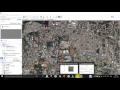 Download Very High Resolution Georeferenced Satellite Image
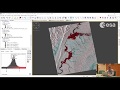 ESA Echoes in Space - Hazard: Flood mapping with Sentinel-1
 Sentinel 1: Basic Image Visualization and Analysis
 Access to Copernicus Data: Overview and Introduction
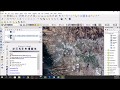 Downloading and preprocessing Sentinel 2 images using the Semi-Classification Plugin in QGIS 3.0
 Descargar Imágenes SENTINEL 2, para ArcGIS, Envi, Erdas (2016) | MasterSIG
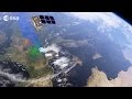 Moving ahead with Sentinel-2
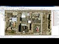 Download very high resolution satellite image 0.3 metre for free
 Supervised Classification of Sentinel-2 Images
 Sentinels for Copernicus
 Download and georeference Google Earth images in QGIS 2.8 with OpenLayers Plugin
 How to Visualise Sentinel 3 Data
 How to Download ESA Sentinel 2 Satellite Images
 SAR Analysis Made Easy with ENVI SARScape 5.1
 RUS webinar: Snow Cover Mapping with Sentinel-2 - CRYO03
 Exploring Sentinel-2 multi-spectral band combinations in SNAP
 Sentinel 2 natural image data processing
 Land use/cover classification using sentinel 2