Quick Terrain Modeler Tutorial - Point Cloud Classification & Building Extraction
Brief overview and tutorial for QT Modeler's point cloud Classification & building extraction tool. This is an easy and powerful tool which can:
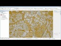
- Automatically classify point clouds
- Automatically identify and extract building footprints, roof outlines, and centroids.
- Create a Digital Terrain Model (DTM , aka "bare earth)
- Create a Digital Surface Model (DSM)
- Edit and clean up results manually with easy, specialized tools.
- Export a wide variety of products to different platforms.
Видео Quick Terrain Modeler Tutorial - Point Cloud Classification & Building Extraction канала Quick Terrain Modeler
Показать
Комментарии отсутствуют
Информация о видео
Другие видео канала
 LiDAR Building Extraction Tool Tutorial (Full Video)
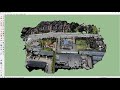 How to create 3D environment models from drone images
 Quick Terrain Modeler: Importing LAS to DEM/DSM
 Photogrammetric point cloud classification made fast with Pointly ✔️
 Ground classification of UAV based Photogrammetric Point Clouds - Intergeo 2020 recording
 Agisoft Photoscan Professional Tutorial: Creating a DEM without GCPs
 Quick Terrain Modeler Getting Started 1 of 10
 Printing Cities: Part One
 Classify groups Tutorial
 Cloud Compare 2: Point segmentation
 Quick Terrain Modeler Above Ground Level (AGL) Analyst
 Processing Drone Images with GCPs using Pix4D Mapper
 Free Point Cloud Software - VisionLidar LTD
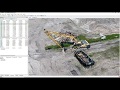 Agisoft Metashape Tutorial - Full Processing from photos to dense cloud - with Ground Control Points
 Pix4D Mapper - Generating a Digital Terrain Model
 Agisoft Metashape - How do I filter out noise cause by water?
 Cloud Compare 6: Colouring LiDAR point clouds for Sketchfab with CC and LAStools
 Quick Terrain Modeler Getting Started - Part 2 of 10
 LiDAR Surface Models in ArcGIS Pro
 Quick Terrain Modeler Getting Started 7: Editing